Treasure of the week no. 15: Tinners and bonnet-makers: The working classes of 1851

JND 197/23 (Please quote this number if requesting this item)

BAKER, Robert.  The Present Condition of the Working Classes. Considered in two lectures delivered before members of the Bradford Church Institute. Bradford: H. O. Mawson, C. Stansfield, J. Dale, H. B. Byles, and other Booksellers.  1851. 62 pages.

working

I recommend this substantial booklet to anyone interested in mid-nineteenth-century Bradford. The print is small and the prose dense, but it is factual (with statistical tables), wide-ranging, objective, detailed, and contemporary with the scene it describes: a sort of textbook of the times. Chapter headings are:

  • The Working Classes as a Body Considered
  • Their Hours Work – Legal and Conventional
  • Their Intellectual State
  • Their Social State
  • Their Morality
  • Strikes

But who were the working class? The author excluded ‘Domestic Servants, Labourers, and those who work in Manufacture and Mines’, but the list of those included in one of the statistical tables gives a useful picture of the ‘Labour Trades’ of old Bradford:

  • Bakers
  • Brewers
  • Butchers
  • Brick-makers
  • Bricklayers
  • Joiners
  • Masons
  • Painters
  • Sawyers
  • Plasterers
  • Blacksmiths
  • Cabinet-makers
  • Engineers
  • Iron manufacturers
  • Nail makers
  • Glass maker
  • Potters
  • Tinners
  • Wheelwrights
  • Shipbuilders
  • Coach makers
  • Curriers
  • Boot & Shoe makers
  • Tailors
  • Carters
  • Hawkers
  • Milliners & dress-makers
  • Sempsters & stresses
  • Stay-makers
  • Straw-plaiters
  • Strawboard-makers
  • Bonnet-makers

An aside it is frequently unknown how the library acquired its pamphlets, but not this one. It is stamped: British Museum Duplicate Transferred.

Stackmole

TREASURE OF THE WEEK No. 14: POLICE DUTIES IN 1848

JND 197/17 (Please quote this number if requesting this item)

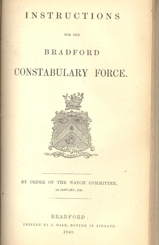
BRADFORD CONSTABULARY FORCE. Instructions for the Bradford Constabulary Force. Bradford, J. Dale, Printer. 1848. 76 pages.

jnd 197 17 001

This weighty booklet published ‘By Order of the Watch Committee’, describe the duties of the early police force in Bradford.

After describing the duties of the various ranks of the police force from Constable, through Sergeants, Detective Officers, Superintendent to Chief Constable, further details are given of these various duties. Topics covered include:

  • Felonies
  • Misdemeanours
  • Riots
  • Assaults
  • Breaches of the Peace
  • Breaking open and entering Homes
  • Arresting Offenders
  • Executing Warrants
  • Removing Articles from the Pinfold
  • Opening Sewers
  • Keeping Order in the Streets
  • Affrays and Riots at Night
  • Felonies, Robberies, etc.
  • Calling for Assistance
  • Giving Evidence

The publication includes several forms and lists, including details of The Riot Act; Names of Keepers of the Keys of Fire Engines, and Sweeping of the Streets.  In the latter all 130 streets, or parts of streets in Bradford Town are listed with how often they are to be ‘swept’ (i.e. patrolled). Most are to be swept once a week, but Hall Ings, Broadstones and Well Street are three streets which are to be swept three times weekly. There is an impressive and immaculately compiled six-page index. Under ‘A’ are:

  • Abusive Language, Constable cannot Arrest for
  • Affrays
  • Arrest, How to be made
  • Assault
    Whether a Constable may Arrest for
    When a Constable cannot Arrest for
  • Assistance, Calling for

A fascinating and detailed insight into a community developing social control.

Stackmole

Map of the Week: Bradford in the mid-nineteenth century

For this article I have drawn on details from two maps in the Local Studies Library reserve collection. Often I have to estimate the dates of plans and maps so it is a relief to have this information provided for once. Both maps have Bradford’s railway connection from the north-west at their heart.

The first is described as ‘Regina v The Midland. Railway Company, plaintiff’s plan, showing Commercial Street previous to 1849’. The second is entitled as a ‘plan of part of the Borough of Bradford showing the Midland Railway Station and Approaches, 1863’.  The maps can be reasonably regarded as showing the situation at the time of the 1851 and 1861 censuses. An even better match for the second map is the Jones Mercantile Bradford Directory 1863, made available on line by the Bradford Family History Society:

http://www.bradfordfhs.org.uk/files/Trade%20Directories/JMDB1863.pdf

In 1847, just before the date of the older map, Bradford had become a Borough.  In the mid-nineteenth century the skeleton of the modern city was in the process of erection.  Bradford Infirmary had been  built on its Westgate site in 1844. The building has been long demolished but Infirmary Field survives as a green space. In the 1850s St George’s Hall, Peel Park, and Sir Titus Salt’s Saltaire were all created. The first work on Little Germany was being done in the 1860s, as the second map was being surveyed, but would continue for several decades.

The Bradford canal had opened much earlier in 1774 and ended at a canal basin and a large warehouse. These locations show well on the earlier map. Nearby, at the end of Well Street, is a large coal staithe. This had been present for many years and also features in a map of c.1825 where it is identified as ‘J.J. & Co’. Sadly I cannot identify the owner. The movement of coal was an important consideration in the minds of the original canal promoters, but water transport of goods was in large part superseded by the railway. The Leeds-Bradford Railway, in which George Hudson ‘the Railway King’ was closely involved, arrived via Shipley in 1846. The route to Keighley was created the following year. To construct the line’s terminus Dunkirk Street was razed to the ground and on 5 March 1846 the Bradford Observer noted the ‘deserted and desolate’ street. Two years earlier a famous resident had died there at the age of 46 years. This was Reuben Holder who was noted, as the same newspaper observed, for ‘eccentric rhymes with which….he was wont to create lights and shadows for the monotonous occupations of brick maker and bill sticker.’

Our map showing the situation in 1849 describes the building as ‘Leeds & Bradford Railway Station now called Midland Station’ which strongly suggests that the great Midland Railway Company acquired the line soon after that year. The 1850 Bradford directory still uses the Leeds-Bradford name and gives the address as ‘bottom of Kirkgate’. Its superintendent is Mr M Crabtree. The map would seem to have been drawn up for litigation purposes but what the action actually involved I cannot establish. The whole district between the station and Cheapside seems to have been known as Bermondsey in 1849 and this appellation survives as a road in 1863. Is the name Bermondsey ever used today?

On the left of the 1863 map you can see Trafalgar Street with its well-known brewery. The Trafalgar Steam Brewery had been founded in the 1850s and in this period was associated with the name of Cllr. Charles Waller. The company regularly advertised its porter, mild, and bitter beers in the pages of local newspapers. It survived until the 1930s, but I’m really not sure what they did with the steam. Manor Row had been constructed in 1820. The map of 1863 clearly shows the place where Manor Row and North Parade divide. On this spot one of Bradford’s most iconic buildings, the Yorkshire Penny Bank (1895), was eventually constructed, the architect being James Ledingham. Opposite this junction was the Bradford Grammar School with School (or Grammar School) Street.  John Richards was its headmaster in the 1850s. I believe the the history of the school stretches back into the Tudor period but the building in North Parade or Manor Row was constructed in 1820. There is known to have been an earlier school building near the cathedral.  BGS has occupied its Keighley Road site, once the centre of the Clockhouse estate, since shortly after the Second World War.

Salem Street, with its listed early nineteenth century terraced houses, was presumably named after the nearby Congregationalist Chapel. ‘Salem’ is a shortened form of Jerusalem and was a popular name for non-Conformist places of worship. This classical revival building was constructed in 1835-6 using ashlar sandstone. It was one of the earliest designs of the Lockwood & Mawson architectural partnership who later moved on to St George’s Hall and Saltaire.  I have included William Mawson’s portrait from his obelisk at Undercliffe cemetery.

Map of the Week 024 C

William Cudworth records that Salem’s minister during the mid-19th century was Rev J C Miall. A new chapel was opened in Oak Lane in 1888 after which the Manor Row building was reused as school board offices, and a school clinic for many years. It still exists as Kenburgh House. While considering churches the 1863 map shows Christ Church in Darley Street which was built as a chapel of ease for the Parish Church and consecrated in 1815. It was close to Bradford market but I believe that the site was eventually needed for a Darley Street extension. The building was demolished in 1879 and Rawson Square exists at its former site. The church was moved to nearby Eldon Place where it survived until 1940.

My limitations concerning Bradford theatre history have been exposed before but there clearly was a Duke Street Theatre in 1863. On this occasion I have retrieved information from Arthur Lloyd’s theatre website:

http://www.arthurlloyd.co.uk/BradfordTheatresIndex.htm

In 1841 the Liver Theatre, Duke Street, probably became Bradford’s first purpose built theatre. In 1844 it was remodelled and re-opened as Theatre Royal, Duke Street. The fact that it was widely known as the ‘wooden box’ may say something about its construction. In 1864 the Alexandra Theatre had opened in Manningham Lane. Five years later, when the Duke Street Theatre Royal finally fell victim to another series of Bradford street improvements, the Alexandra took over the discarded name.

If from Duke Street you continued down Piccadilly and across Kirkgate you would be walking down Piece Hall Yard. According to the City Heritage blue plaque the Bradford Piece Hall had been constructed in 1773. The development of a building for trading in ‘pieces’ of cloth had been proposed by the hugely influential Quaker merchant John Hustler who died in 1790. I’m not sure when the Piece Hall was demolished, in the late 1850s perhaps. Piece Hall Yard has been, since 1877, the location of the Bradford Club. Today the Club holds an importance for Bradford studies second only to the Local Studies Library itself, since it generously allows the Bradford Historical & Antiquarian Society and the Bradford U3A to hold their meetings within its gracious portals. John Hustler’s name survives in Hustlergate. In the newer map this is recorded as the site of the Old Market but the Gothic revival Wool Exchange, which survives largely as Waterstones, was built here a few years later, between 1864-67. It was another design of Lockwood & Mawson. The foundation stone laid by Lord Palmerston, and some magnificent glazed ceramic tiles, can still be seen in the Market Street pizza restaurant.


Naturally there is a great deal of history locked up in street names. Hustlergate has already been mentioned and Market Street must reflect the old market. But look at the streets at the top right of the second map. A water source is the obvious explanation for Well Street. The older map indicates that Collier Street (or Gate) was named for its closeness to the coal staithe. The Swaines and the Booths were wealthy local families and Charles St, Booth St, and Swaine St probably all derived their names from Charles Swaine Booth Sharp (1734-1805) who owned land in the area of Hall Ings and married Hannah Gilpin Sharp, who had inherited Abraham Sharp’s Horton estate via his niece Faith Sawrey. The name Brook St must reflect the course of the Bradford Beck. This is seemingly on the surface before 1849, but the 1851 and 1861 Bradford maps suggest that it was by then culverted and underground at this point. Only the names Well St and Market St have survived to the present day.

Derek Barker, Local Studies Library Volunteer

Map of the Week: Turf Tavern & Airedale College

Old plans of Heaton, my own part of Bradford, are not very common in the Local Studies Library map collection. In the late 18th and early 19th centuries a great deal of the land in the township was owned by the Field family. On the death of John Wilmer Field in 1837 this estate passed quietly, by virtue of the marriage of his daughter Mary, to the future Earl of Rosse. Land sales often generated surveyed plans and it is not surprising that the area identified in the first map was not part of the Rosse estate and so did change hands.


The 3rd Earl of Rosse died in 1867 so the map must be later than this date since his Countess is identified as a neighbouring landowner. She took over the direction of her Heaton and Shipley property until her own death in 1885. By this time portions of property was being offered for sale with villa development in mind. The present Earl of Rosse still maintains an archive at Birr Castle, Co. Offaly, Eire where many historic maps and documents are curated. But any questions readers might have about this area can almost certainly be solved more accessibly by consulting Heaton: the best place of all by the late Stanley King, the premier student of Heaton history. Several copies of his work are available on the library shelves.

Map of the Week 023 A

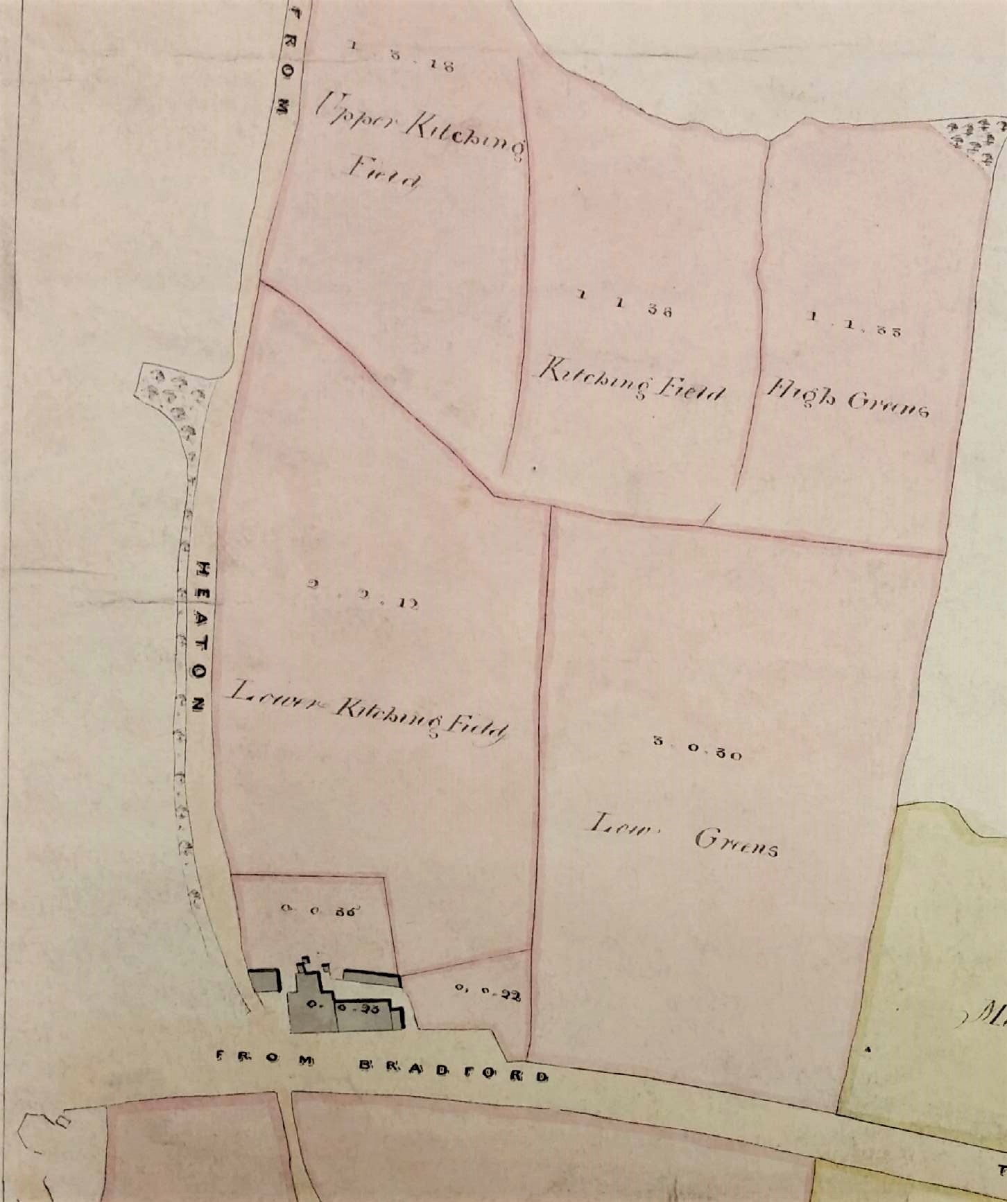
The map probably dates from c.1875 since it shows a block of land near the corner of Emm Lane and Keighley Road on which it was proposed to build Airedale College. This was to be dedicated to the training of Congregationalist ministers. An earlier college had been in existence at Undercliffe since 1831. The new premises at Heaton were opened in 1877 but the name was changed to United College in 1888, following the closure of a similar institution at Rotherham. The building is now part of the University of Bradford. Another part of the Emm Lane University Campus is an adjacent house named Heaton Mount which was built in 1863 by Robert Kell, whose name appears near the top of the map. Throughout this period Heaton did not form part of the Borough of Bradford; its incorporation was not until 1881. In fact the map even pre-dates the construction of Heaton’s first public sewer which, according to Stanley King, only occurred in 1877. The resulting sewage was discharged straight into the Bradford Beck which is really not a pretty thought. It looks as if the site destined for the college was part of a small parcel of land called the Turf Tavern Estate. The three field names are given as: Top Close, Quarry Field and Kitching Field.

The Local Studies Library has a second earlier map of 1840 which suggests that most of the area was then called Kitching Field, Kitching being a well-known local surname. Perhaps there was a small quarry here between 1840-75 that accounted for the name change. The Turf Tavern itself, briefly known recently as The Park, is present on this 1840 map and all the OS maps of Heaton. There is a datestone above the door carved with the year 1894, but this must indicate a rebuilding since the original structure was much older. Historian William Cudworth suggests that the tavern, and the nearby Branch Hotel (formerly the Coach & Horses), were both erected when the Bradford to Bingley turnpike was opened in 1825. He records that the builders of the Turf were William Clarke, a Heaton butcher, and his brother Joseph, a stonemason. Another brother, John Clarke, developed many delphs or quarries around Heaton village, although all evidence of those has long since vanished. The owner of the Turf Tavern estate at the time of the first map is likely to have been William Lister Marriner of Greengate House, Keighley. His family came into property around Frizinghall by marriage. Local historian Tony Woods has confirmed their possession of this area from the Heaton Local Board Rate Books 1860s-1881 (WYAS Bradford Archives BBT6/5/5/1-19). The same family also gave their name to Marriner’s Drive. This roadway is not present on the 1906 OS map but appears on the 1911 Rosse sale plan, without as yet any attendant houses.

Map of the Week 023 B

The sale plans, of which the third map is an example, were produced because in 1911 the 5th Earl sold off all his remaining property in Heaton and Shipley.

Map of the Week 023 C

What else does the first image show? Emm Lane was originally a track through Emm Field (perhaps originally Elm Field) when this was one of the three ‘great fields’ of Heaton in which farmers were allotted strips of land to cultivate. Nearby Manningham Park, now Lister Park, was originally a deer-park surrounding Manningham Hall, the home of the Cunliffe Lister family. The land was eventually purchased by Bradford as a public open space and Cartwright Hall, which opened in 1904, was built as an art gallery and museum. I’m not sure about the building in the extreme right of the map, above the words ‘to Bradford’. I think the same structure appears, sketchily drawn, at the bottom left of the second map. This area was called Carr Syke and there was known to be a turnpike toll house in this position. The fairly substantial building is drawn and identified in the Heaton tithe map but does not seem to be clearly indicated in the 1852 OS map for some reason. The Turf has recently been sold and I am not sure what future is planned for it. Hopeful the building will survive to feature in further Heaton maps.


Derek Barker, Local Studies Library volunteer

Treasure of the week no. 13: Arctic explorer defends the Church in Bradford

JND 197/14 (Please quote this number if requesting this item)

SCORESBY, Rev. W.  The Position of the Church, and Duties of Churchmen to Unite for her Defence. An Address delivered at the formation of The Church Institution at Bradford, July 4th, 1843. Published at the request of the meeting. Reprinted for the Halifax Guardian by J. U. Walker of Halifax. 28 pages. 1843.

jnd 197 14a 001

In the early years of the reign of Queen Victoria, the established Church of England was under threat from the growing number of rival non-conformist churches such as the Methodists, Baptists and Quakers. This pamphlet records an address by the Vicar of Bradford, the Rev. William Scoresby, to the Bradford clergy, at the formation of The Church Institution which would focus on the defence of the Church. After the meeting the following invitation was issued:

‘To the Churchmen of the Parish of Bradford’:

We, the undersigned, Invite the Attendance of Members of the Church (Females as well as others) at a meeting to be held in the large room recently occupied by the Socialists, in Hall Ings, on Tuesday, July 4th, 1842, at Half-past Seven in the Evening.

William Scoresby, Vicar of Bradford
J. Fawcett, Incumbent of Wibsey
W. Sherwood, Incumbent of St. James
J. Cooper, Incumbent of St. Jude’s
G. A. Hamilton, Incumbent of Wilsden
T. Newbery, Incumbent of Shipley
J. Barber, Incumbent of Bierley Chapel
J. L. Frost, Incumbent of St. John’s, Bowling
P. Bronte, Incumbent of Haworth
J. Bourne, Incumbent of St. Paul’s, Wibsey
G. Thomas, Incumbent of Thornton
J. C. Boddington, Incumbent of Horton

It is interesting to see who were the ministers of the churches in Bradford at this time – the Anglican Churches.

The phrase ‘Females as well as others’ is a little odd. Who are the ‘others’? 1843 is a little early for ‘transgenders’!

The appearance of Patrick, father of the famous Brontë sisters, and ‘Socialists’ in the same 1842 document is also a surprise; it got me wondering when the phrase ‘socialist’ was first used.

The Rev. Dr. Scoresby was a renowned scientist and explorer before coming to Bradford. He was Vicar from 1839 to 1847. He did not have an easy time.

Stackmole

jnd197 14b 001William Scoresby 001