Neglected Bradford industries: Coal mining

Bradford is famous for spinning and weaving but textile production was only one of a group of important industries which ‘Worstedopolis’ supported.  Since several are now almost forgotten by contemporary citizens I should like to draw attention to those which seem unreasonably neglected, in a series of short articles.

Bradford lies on the northern edge of the great Yorkshire & Nottinghamshire coal field. The solid rocks under the city, called the ‘Coal Measures’, were laid down on top of the Millstone Grit in the Carboniferous geological period around 320 million years ago. In the Carboniferous ‘Bradford’ was near the equator and must have witnessed episodes of luxuriant tropical fern and horsetail growth, together with muddy coastal lagoons, vast debris deposits from a river delta, and occasional incursions of the sea. A little like the Florida Everglades today perhaps. The rocks created in this way resemble a pile of sponge cakes cut in half and consisting of layers of grey mudstone, sandstones, coal and fireclay. All these minerals once had a commercial value. The remains of many living creatures survive in mudstones or sandstones.  Cliffe Castle Museum, Keighley has an important collection of such fossils.

If you examine any portion of the first Ordnance Survey map of Bradford, surveyed in the late 1840s, you will see collieries, coal pits and ‘old pits’ scattered everywhere. Coal production was clearly a huge industry and in the 1860s Bradford produced as much of the mineral as Barnsley. In addition to a domestic supply coal was needed for coke manufacture, town gas production, and to power many hundreds of the Borough’s steam engines. It would have fuelled industries such as brick-making and lime-burning which will be examined in future articles. Coal was brought into the town centre and sold from staithes, this being a place adjacent to a highway from which merchants could collect a supply for subsequent delivery to their customers.

02 Image A

This 200 year old map of east Bradford shows the position of two coal staithes. The date is probably around 1825 since Leeds Road is labelled as ‘New Road’.

In this map one staithe is clearly marked J.S. & Co. This must represent John Sturges (or Sturgess) & Co., which was the company that operated Bowling Iron Works. The ‘new rail road’ drawn is in fact a mineral carrying tramway bringing coal in trucks to the Eastbrook staithe, by rope haulage. There is second coal staithe (or stay) at the junction of Well Street and Hall Ings. This is evidently operated by J.J. & Co. who I cannot yet identify. There were staithes adjacent to the canal basin and the bulk transport of coal was very much in the minds of the first canal promoters.

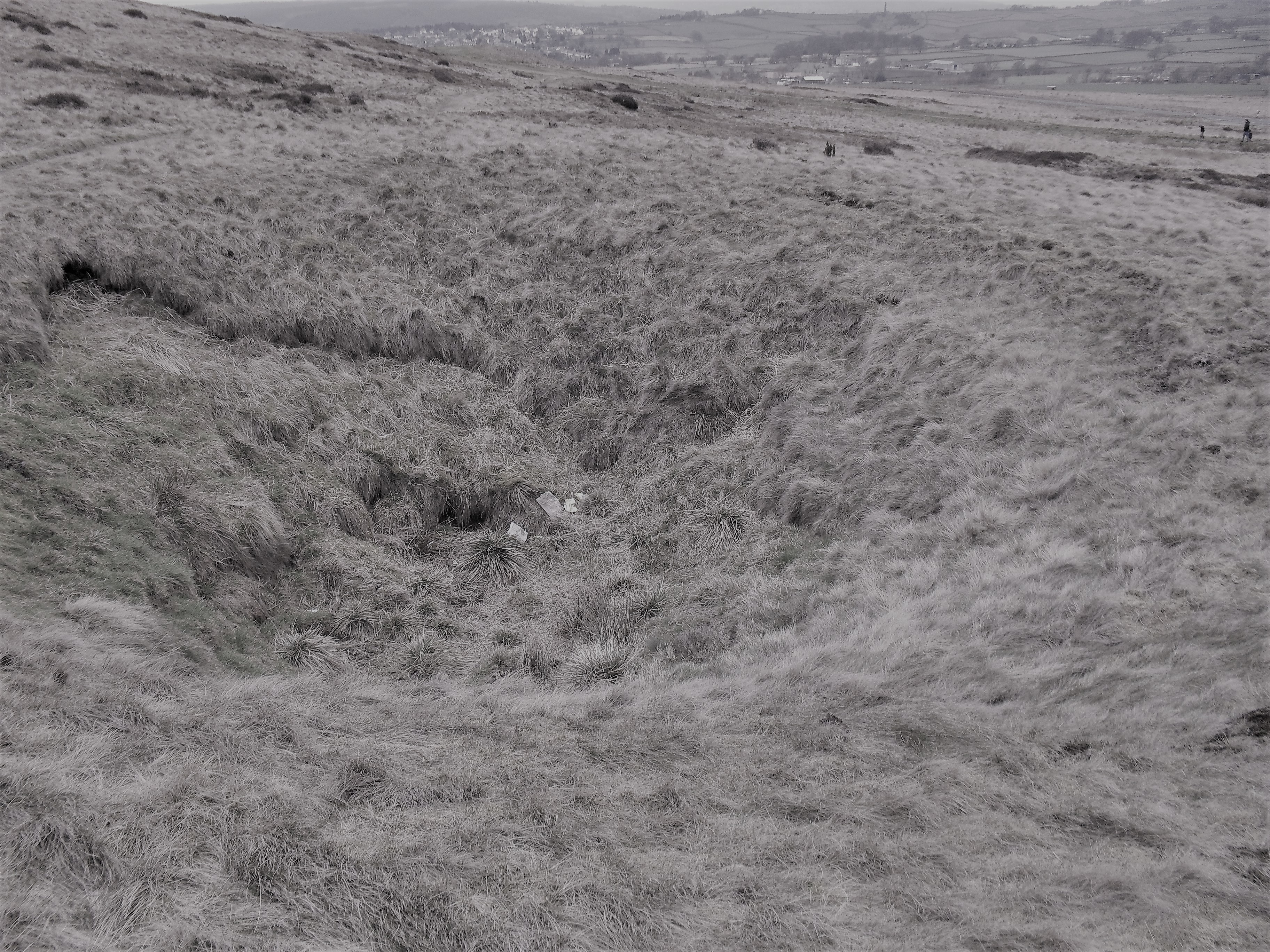
In north Bradford the coal mined was largely from the Hard Bed, Soft Bed and 36-Yard seams which are the deepest in the Coal Measures. As you move up the Aire Valley from Bingley towards Keighley there were a further set of collieries based on even deeper seams of coal in the underlying Millstone Grit series of rocks. Coal mining in north Bradford may have been very extensive, but the coal seams were thin and relatively unproductive.  At the better capitalised late 18th and 19th century south Bradford pits mineral tramways took at least 50% of the coal mined to supply fuel for the profitable blast furnaces at Bowling and Low Moor. Here thicker seams, higher in the Coal Measures series, were exploited. Ironstone and coal were removed from the Black Bed and, underneath this, the Better Bed provided coal low in sulphur and phosphorus, ideal for coke fuelled iron smelting. Most old mine workings are now concealed by urban development but even today walks in Heaton or Northcliffe Woods, or on Baildon Moor, will reveal unmistakable evidence of a mining landscape.

02 Image B

One of the many capped colliery shafts on Baildon Moor.

It is likely that the Romans exploited coal in Britain and there were certainly medieval collieries in northern England. I know of good historical evidence for mining in Baildon, Heaton, Shipley, Frizinghall, and Eccleshill in the early 17th century but the Bradford industry is almost certain to have been older, and more widespread. As an example of the evidence there are a series of West Yorkshire Deeds, published in 1931 by the Bradford Historical & Antiquarian Society,  and available in the Local Studies Library. One deed reveals that in 1684 Ellen Robinson conveyed her ‘Coles, mynes, seames and quarries of cole’ near a place called Mooreside. Would this be the Moorside, Eccleshill where the Industrial Museum is now situated? Remarkably the rent required of William Rawson, yeoman of Bowling, is ‘one red rose yearly’. Was a ‘rose rent’ effectively a way of giving the beneficiary, a relative perhaps, all the income from a parcel of land while not transferring its title of ownership? The colour of the rose is rather surprising if the parties involved were both from Yorkshire.

The earliest mining described by Bradford historian William Cudworth was a little later in 1699 when about twenty freeholders of Bolton entered into a mutual agreement for ‘getting’ coal in that township. The rights to the coal were generally vested in the landowner but a Lord of the Manor retained rights to coal under common land or ‘wastes’. The most frequent way of reaching coal seams was by means of shafts sunk from the surface. Once a shaft was in place the miners created galleries from which the coal was actually removed, with pillars of mineral being left to support the gallery roof. This technique is often called ‘pillar and stall’ mining with the stall (or bord) being the place in which the miners worked at a coal face. Because of these unmined pillars the ‘take’ of coal from a seam may have been as little as 60%. Traditionally coal was not mined under churches, nor the mine-owner’s house!

02 Image C

A beautiful colliery plan from the  reserve map collection showing  pillar & stall mining below Old Allen Common, Wilsden.

As well a shaft to access the galleries a second ventilation shaft was often sunk. When a colliery was working active men were needed as ‘getters’ to hew the coal. If the seams were thin this must have been undertaken in a lying or kneeling position illuminated only by flickering candlelight. Hewed coal was then conveyed in wicker baskets, called corves, by ‘hurriers’ to the shaft bottom from which it could be wound up to the surface by ‘gins’ of various types. Where the topography was favourable seams could also be approached by driving in roughly horizontal tunnels, called inclines, drifts, or ‘day-holes’. Local mining by both methods is well recorded. For Wilsden, for example, there are maps held by both West Yorkshire Archives (Bradford) and the LSL. The Archives have a plan (WYB346 1222 B16) of Old Allen Common in Wilsden including all its collieries. This was ‘made for the purpose of ascertaining the best method of leasing the coal’ by Joseph Fox, surveyor, in 1829. It shows the area where Edward Ferrand, as Lord of the Manor, had mineral rights over common land.

The name ‘bell pit’ is commonly encountered in accounts of early mining. In this method a short shaft was sunk down to a seam and its base was then expanded as the mineral was removed, creating a bell-like profile. When unsafe, because of potential roof collapse, the bell was abandoned and a new shaft sunk nearby. Each bell was filled in turn by waste dug out of its successor. I feel that if shafts were connected underground, or were drained by a passage to the exterior (called an adit or sough), or had some means of providing fresh air for its miners, it seems misleading to call such arrangements ‘bell pits’. ‘Shallow shaft mining’ is perhaps to be preferred which covers all these possibilities.

If you want to explore local coal mining further I would suggest:

J.V. Stephens et al., Geology of the country between Bradford and Skipton, HMSO, 1953. This is essential reading for geological background to any extractive industry.

Richardson, A Geography of Bradford, University of Bradford (1976). This work provides a gentle introduction to mining as it also does to Bradford’s development.

M.C. Gill, Keighley Coal, NMRS, 2004. A most detailed study by an eminent mining authority.

D.J. Barker & T. Woods, Cash from the Coal Measures: the Extractive Industries of Nineteenth Century Shipley.  Bradford Antiquary, (2013) 3rd series, 17, 17-36.


Derek Barker, Local Studies Library Volunteer



Map of the Week: Eccleshill – coal, iron, and waving wheat.

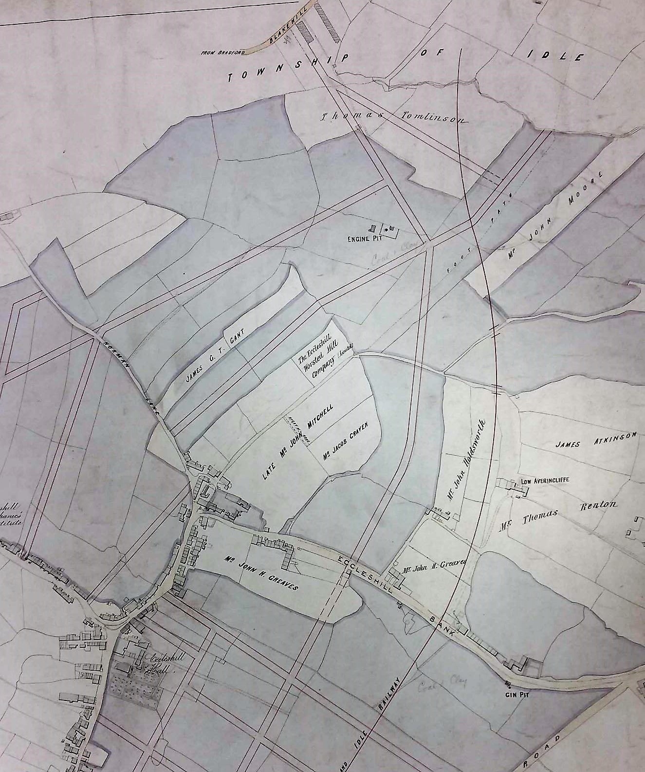
The ancient township of Eccleshill is well represented in the Local Studies Library reserve map collection, although many of the maps are in poor condition. The following images are details which I have enhanced to make them more visible. It is hard to believe today but the whole of Eccleshill was once mined for coal, with mining features commonly being seen on nineteenth century maps of the district. The seams that could be accessed included the Hard and Soft Beds (sometimes called the Upper and Lower Beds) which were widely exploited all over the north Bradford area. Above these in the geological sequence was the important vein of sandstone called the Elland Flags, which was extensively quarried. The well-known George Vint, with his various partners, owned quarries in nearby Idle extracting this valuable rock. Modern geology maps suggest that the centre of Eccleshill was high enough to include the Better Bed coal and fire-clay seams, positioned above the Elland Flags. The Better Bed was also extensively mined as coking coal in south Bradford for the iron-smelting industry at Bowling and Low Moor. William Cudworth, in his account of Eccleshill, mentions the Better Bed, and also an associated fire-clay and brick making industry based at Manor Potteries in Eccleshill.

Ecc1

Click on map to enlarge

The first map shows the township field names with buildings and the names of their occupiers. At the bottom right is Eccleshill Hall built in 1713 and the home of the Stanhope (later Stott-Stanhope) family. As far as I know Lt.-Col. George Stott-Stanhope was the last family member to actually live there. He was a large landowner whose name frequently appears in local maps. He died in 1874 and the hall was demolished in 1878. Slightly to the left you should be able to make out the name J.A. Jowett. This was James Atkinson-Jowett (1817-1886) of the Clockhouse Estate, Manningham. The Clockhouse name survives as one of the Bradford Boys’ Grammar School buildings. James Atkinson-Jowett was the son of Nathan Atkinson-Jowett. Both men changed their surname from plain Atkinson in the 1860s in order to claim the large Jowett property inheritance. The field names are not likely to be easily visible but include: Windmill Field and Tenter Croft. A tenter croft, or ground, was an area used for drying newly woven woollens after fulling. The wet cloth was attached to frames called tenters by means of, naturally, tenter-hooks. Town Street, today called Victoria Road, divides at Bank Top into Norman Lane and Eccleshill Bank, named the ‘Old Turnpike Road’ in early maps. This division is very helpful in orientation, with portions of Eccleshill Bank being included in all the maps included here.

The second, rather clearer, map enables us to examine the northern part of Eccleshill. It is obvious that a planned street grid has been superimposed on an older map but I do not think that all those roads were actually constructed. On the right side of the map a railway line has appeared. The Eccleshill & Idle Railway was incorporated in 1866 and was assimilated into the GNR Laisterdyke to Shipley line. Eccleshill Station was closed to passengers in 1931. A land-owner whose name appears approximately in the centre of the map is described as the ‘late John Mitchell’. Eccleshill historian Ken Kenzie told me that John or Jonathan Mitchell was a coal merchant who once lived at Eccleshill Bank. He was clearly a big man in Eccleshill mining and, among others, ran Park Pits which were sold off in 1860 when he was in his 70s. On the map above his surname you may be able to make out the location of ‘Eccleshill Worsted Mill Company’ and above this, and to the left, ‘Engine Pit’. The enterprises of John Mitchell are well represented in the Local Studies map collection.

ecc2

Click on map to enlarge

The third image is taken from a plan dated 1847 and described as ‘coals leased to Mr John Mitchell, surveyed by Ingle & Smith’. Once again you can see Eccleshill Bank and the fine line grid above it represents underground mine galleries. I presume these were entered from the Engine Pit shaft. Elsewhere the map reveals extensive coal mining to the south-west of the township.

ecc3

Click on map to enlarge

The final map is the oldest and most damaged. In one area I can identify George Baron as a landowner. George Baron, of Drewton in the Wolds, was an earlier possessor of the Clockhouse Estate than the Atkinson-Jowetts. He inherited the estate from Sarah, last of the original Jowett family, and died in 1854. The West Yorkshire Archives (Bradford) has a huge collection of Jowett family documents (10D76/3/190). In box 6 of these is a lease dated 1842: ‘George Baron to John Mitchell, Eccleshill’. This document is a 28 year lease of Upper Bed and Lower Bed coals in the area of Greengates, Eccleshill. The price seems to be £60 per acre. This is somewhat north of the area discussed so far, but Greengates and Apperley Bridge were traditionally considered to be part of Eccleshill.


ecc4

Click on map to enlarge

The short horizontal trackway at the top of the last map is called Green Lane. It joins a bridleway which is now Carr Bottom Lane. We have moved west since the curved roadway at the top left, marked Otley, is the far end of Eccleshill Bank where it joins the Dudley Hill & Killinghall turnpike. A number of coal shafts are present on the first OS map of the area (which is of approximately the same date) together with a limekiln at the end of the short track leading to Wheat Close. I’m not sure if these are drawn here or not since the script is so hard to read. What fascinates me about this map are the field names themselves. At the bottom right you may be able to make out Wheat Close and, below this, Cinder Hills. Today it is hard to imagine ripe wheat being harvested in Eccleshill although we have already mentioned Windmill Field which suggests subsequent grain processing. Cinder Hills is a name normally associated with heaps of iron-making slag. Pre-Industrial iron making has been suggested in other townships which now form part of Bradford: Harden, Baildon and Bierley for example. Faull & Moorhouse (West Yorkshire Survey to AD 1500) speculated that Eccleshill should join this list on the basis of two areas called ‘Cinderhills’ in old township maps.


Derek Barker, Local Studies Library Volunteer
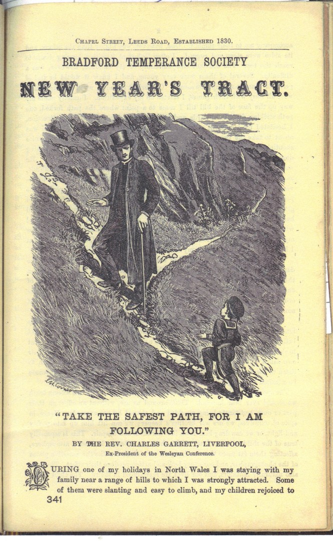
TREASURE OF THE WEEK No. 12 “TAKE THE SAFEST PATH, FOR I AM FOLLOWING YOU

JND 193/21 (Please quote this number if requesting this item)

GARRETT, Rev. Charles. “Take the Safest Path, for I am following you”. Bradford Temperance Society New Year’s Tract.
Scottish Temperance League Monthly Pictorial Tract. 1881? 4 pages.

08-10-2016 17 33 34.JPG

“I beseech the readers to realize the tremendous power which they possess and to resolve by God’s help to tread the path of abstinence, if for no other reason, because the children are following them.”

The Temperance movement was huge in late Victorian Britain. The striking illustration on the front page of this tract was inspired by a holiday in North Wales taken by the author of this tract, the Rev. Charles Garrett of Liverpool, ex-President of the Wesleyan Conference.  Although it may be hard to resist the temptation to drink alcohol, like climbing a mountain, it should be done for the sake of our children, and others, who are following you.  And of course, to take the ‘safest path’.

This New Year’s tract was, as we now say, syndicated.  Presumably the Bradford Temperance Society subscribed to copies of the Monthly Pictorial Tracts produced by the Scottish Temperance League, and then sent to its members.

Stackmole

National Dementia Awareness Week: Memory Boxes

14th-20th May is National Dementia Awareness Week as the Alzheimer’s Society asks people to unite against dementia, to raise awareness and to offer help and understanding.

Memories, first hand recollections and experiences of people are extremely important and valuable to us all and thoughtful and engaging use of reminiscence when used well can be especially effective for those with dementia.

With this in mind we have refreshed and updated the Memory Boxes available to borrow from the Local Studies library.

The packs contain a selection of multi-sensory objects, pictures and memorabilia plus a beautifully illustrated book which reflects the topic.

We all like an occasional trip down Memory Lane and reminiscence can be great fun for everyone involved, as well as being an important activity that affirms our sense of identity.  These Memory Boxes can stimulate arts, history and memory groups. They can be used in a variety of settings including social and community groups, day centres and residential homes.

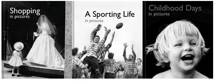
Our boxes include a book in the series of ‘Pictures to Share’ books designed for people with dementia. These books can help and encourage communication and discussion when shared with carers, provide a calming activity for the person to do alone, and promote a feeling of worth and well-being.

memory books

Pictures to Share books are based on a variety of general themes. They include a wide selection of powerful, colourful and attractive images and texts.

For more details please see our leaflet here:

Memory boxes for reminiscence

Bradford Libraries would like to thank the ‘The Memory Bank’ forum for creating the original concept and sourcing artefacts which form the basis of these collections.

A Bradford Childhood 1944-1955 – Part 3

Our move from Thornbury to Eccleshill inevitably involved enrolment at a new school:

Wellington Road Junior School was about a mile away from where we lived, and I walked there and back, lunchtimes included, every school day until I was eleven.
It was stone built with slate roofs and mullioned windows, some of them gothic in shape and set high in the walls. There was a bell tower near the head teacher’s office and this had an inscription in the stone that indicated it was an original Board School built in 1880.

I had several teachers in the earlier part of my stay there, but for my last two years leading up to the 11 plus I was very much under the permanent influence of Miss Davis, probably the most senior teacher in the school other than the head. She was highly respected, strict, methodical, skilled and sensible.

She was probably in her fifties when I knew her. She was of average height, quite slim, had a longish face and wore her greying hair swept into a bun at the back of her head. Like my mother, she put on a little make up and powder. Everything about her was sensible and controlled. She wore long, sensible woollen or worsted skirts, often some kind of herringbone or plaid, and a smart woollen twin set or blouse and cardigan and low-heeled shoes. She occasionally chose to wear some simple jewellery: a brooch, or a modest string of pearls, but no rings.

She read to us a lot in the afternoons. She would let us engage in simple handicrafts while she read, the boys often crocheting long chains of wool via the holes in old cotton bobbins. One afternoon she involuntarily revealed the softer side of herself when reading a sad passage from ‘Uncle Tom’s Cabin’:

We were all listening and knitting or crocheting when we suddenly realised the narrative had stopped. When we looked up we saw that Miss Davis was attempting to say the words, but no sound was coming out, and that tears were streaming down her face. Eventually she stopped attempting to read and began to sob, her shoulders heaving and her face beginning to contort. Two girls stood up and walked down the stepped aisle and made awkward attempts to comfort her. The rest of us looked on in stunned silence.

She recovered and eventually carried on reading, but the incident always stayed in my mind and often in later years made me think about the power of art and the mysteries of the human soul.

My father was determined I should go to grammar school but some of the coaching he organised for me at home didn’t always bring happy results:

One evening I became so upset and frustrated, I threw the pen down on my exercise book and swore, saying I would never do any more, ever. The action produced an explosion of ink from the pen resulting in a huge blue-black arc on the wallpaper of the adjacent wall complete with drips and runs flowing downwards from the ceiling to the skirting board. There was silence apart from my mother’s tears, and then she attacked my father verbally and I was forgotten in the midst of their bickering.

By the time of the examination itself I had IQ tests coming out of my ears and I had more or less forgotten it was even going to happen:

There was no warning given before the day that we were to begin our 11+ examinations. I remember walking, as usual, along the Harrogate Road to school on a blustery spring morning happily fascinated by straining trees, glinting puddles and ragged crows flung about in the sky, unaware something serious was about to happen. Only when required to file through long rows of quiet, sombre desks that had appeared overnight in the main hall outside our classroom did I realise that the long anticipated day had arrived. Miss Davis took the register and had a few discreet words about it being the first day of the dreaded 11+, how we should not be flustered by the event and should approach the whole thing with confidence. We entered the hall, took our places where our names were written on a card on a desk, together with a number, and then, when prompted, began to read the instructions, fill in our individual details, and answer the questions.

Taking the 11 plus was the last significant thing I did in Bradford. After that, we moved across the Pennines to Cheshire and my Yorkshire citizenship was ended. Except that it wasn’t, of course, because it never leaves you no matter where you go or how old you become. Yorkshire remains my spiritual home even though I am no longer a resident. My childhood experience in Bradford was enormously important to me and I suppose that is why I felt impelled to write about it. I was just turned seventy when I started to write and I didn’t want to lose the memory and, more importantly, I wanted to share it with my children and anybody else who might be interested to read it.

If you take the whole piece out to read, I hope you enjoy it and that it might either remind you of your own early life or give a reasonably accurate account of life as it was lived by a little boy in Bradford immediately after the Second World War.

Bob Nichol

Bob Nichol