Continental Coffee House/Godwin Street

An enquiry was received recently in Bradford Local Studies library for photographs of the Continental Café on Godwin Street from the 60’s and 70’s. The downstairs area of the café was known as the ‘Hole in the Wall’ coffee bar.

These images show the lower part of Godwin Street and the Continental Café can be identified on the right by the distinctive ‘Coca Cola’ sign.

In the late ‘60s and early ‘70s the cafe was frequented by Mods of the day who would park their scooters the full length of Godwin Street. Thanks to our enquirer for this detail and the trip down memory lane.

KM1817943243-20191210153720

Bradford looking towards Sunbridge Rd’, Jack Booth collection, 11.11.1973

KM1817943243-20191210153646

Godwin Street, Bradford Libraries collection, date unknown


Women of Bradford: Heritage walk

Manningham Library

001Manningham Library

Manningham Library was the start of this fascinating guided heritage walk by Helen Broadhead on 21st April.

This historic building was first opened in 1910. Four decorative stone works on the front of the building feature great writers: Chaucer, Shakespeare, Milton and Wordsworth.

Today as part of Bradford Library Service this library offers the full rage of library services including books in a range of languages, children’s activities, free internet access, daily newspapers and access to local and family history information.

Manningham Tradesmen’s Homes

Nowadays these houses provide retirement accommodation. However these beautiful houses and chapel that form a peaceful oasis in the centre of this bustling area of Bradford were built for a special purpose: to house ‘decayed tradesmen’.

The charity commission website states:

“Objects TO ERECT AND MAINTAIN AT LEAST THIRTY DWELLING HOUSES FOR DECAYED TRADESMEN AND OTHERS, BOTH MALE AND FEMALE, WHO HAVE AT ONE TIME OCCUPIED A GOOD POSITION IN SOCIETY, BUT THROUGH ADVERSE CIRCUMSTANCES HAVE BEEN REDUCED TO COMPARATIVE POVERTY AND NEED BENEVOLENT AID TO ENABLE THEM TO KEEP CLEAR OF PUBLIC CHARITY.”

The plaque reads:

Tradesman's homes 3


Lilycroft Primary School

IMG_8977

The plaque reads:

‘Miriam Lord 1885 – 1968 Champion of the Nursery Children. She was the first head teacher in 1921 of the Lilycroft Open Air Nursery School with its emphasis on outdoor play, visitors came from across the world to see the new nursery movement in action. The school is behind the primary school. Erected 2007.’

Her work was influenced by Margaret McMillan who worked on the Bradford School Board and aimed to get free school meals and milk into schools.

Bradford Local studies Library is now sited on the side of the building now known a Margaret McMillan Tower.

Manningham Mills

Manningham Mills strike centenary

The plaque reads:

‘Manningham mills Strike Centenary 1890-1990. At this place in December 1890 began the Manningham Mills strike which lasted until April 1891. This led to the founding of the Bradford Labour Union which in turn saw the formation of the new national independent Labour Party in Bradford three years later.’

Manningham Mills was otherwise known as Lister’s Mill. This was once the largest silk factory in the world. It was built by Samuel Cunliffe Lister to replace the original Manningham Mills that were destroyed by fire in 1871. At its height, Listers employed 11,000 men, women and children.

The chimney of the mill is 249 feet (76 m) high, and can be seen from many areas of Bradford

Manningham Mills

Bradford Children’s Hospital

Bradford Children’s Hospital on St Mary’s Road, Manningham, the hospital first opened in October 1890.

The hospital, with its distinctive round wards, touched the lives of many Bradford families over the generations.

Now this fine building has found a new purpose as a Shia Mosque.


Thank you to Helen Broadhead for this journey of discovery around the streets of Manningham and for sharing her thorough research and knowledge of the local area. Helen’s guided walk around these iconic locations in Bradford was full of the stories of inspirational women and men who lived, worked and campaigned in the city for social improvements and justice.

0000HelenBroadhead

Greengates

SITUATED around three miles north of Bradford, Greengates  is unfairly known by many as no more than the busy Bradford to Harrogate and Leeds to Keighley crossroads.  Its boundaries, however, spread beyond this busy junction. The actual parish boundaries show that Greengates includes parts of the Thorpe Edge and Ravenscliffe estates and Apperley Bridge.

Map

Map of Greengates, 1908


Greengates is not an ancient village with its roots going back to Saxon times. It is simply a village of the Victorian era, built with the grey Yorkshire stone of early Victorian prosperity.  In fact little of Greengates nowadays is more than 60 years old.

The village, like many others in Bradford, has now been swallowed up by the city.  However, some of the prettier and more interesting qualities of the place still exist.  Take, for example, the row of cottages in Stockhill Fold.  They were built for weavers and some date from as early as 1786.  They were renovated in 1979.  The builders and architects ensured that many of the original features were retained.   In fact, Methodist pioneer John Wesley is reputed to have stayed in one of the cottages. They are all now listed buildings.

Stockill Fold

Weavers Cottages in Stockhill Fold, 2002


Another of the village’s most famous landmarks is its war memorial, situated at the busy crossroads. The imposing angel statue was erected in memory of the men of Greengates who died in World War One.

War Mem

War Memorial, 2002


Some older people may still remember with affection Greengates’ mills, or the acres and acres of green fields that surrounded the village before the arrival of the large housing estates in the area. Some people may also remember some of the district’s characters.  There was the hermit who lived on the moors of Thorpe Edge,  before the estate was built there.  He was known as ‘Pit Dick’, living in one of the old mines that used to be dotted all over the moor. His real name was Richard Bolton. Local lads used to tease him and pinch his possessions.  The girls, though, were scared stiff of him.

Then there was Greengates’s own ‘Wee Willie Winkie’, Joshie Cockey.  He was employed as a ‘knocker up’, by the local mill owners.  Some may remember the time when he knocked everyone up an hour early.  When he realised his mistake he had to to go back on his rounds letting folk know that they could have another hour in bed.

Greengates was a real centre for Methodism in Bradford. The first group met there in 1781, the year Wesley was supposed to have stayed in Stockhill Fold. Methodism prospered and meetings were held in a building in Haigh Hall Road. This building eventually became Greengates Library as well as a burling and mending workshop.

Today Greengates can certainly be a bottleneck.   The busy junction at its centre, known as New Line, is now under more pressure with the arrival of supermarkets and retail parks.  Next time you’re doing your weekly shop in Sainsbury’s, or travelling between Shipley and Leeds or  Bradford and Harrogate, spare a thought for what used to be a small, quiet village, with superb views over  the Aire Valley.

New Line

New Line, Greengates, in more peaceful times

Taken from The Illustrated History of Bradford’s Suburbs, 2002

The Township of Idle

This article is an extract from The Illustrated History of Bradford’s Suburbs 2002

THE township of Idle, to the north of Bradford, has always been quite large in both area and population. William Cudworth described the extent of Idle in Round About Bradford (1876) as reaching ‘…from Apperley Bridge to Windhill Bridge, and from Buck Mill to Bolton Outlanes’. The population today, due to the new housing developments that rapidly appeared from the mid – 20th century onwards, is near to 10,000.

The origins of the name Idle can be the subject of much speculation. The spelling of the word in historical documents is often Odell or Ydell, and J. Horsfall Turner, the noted Bradford historian, stated that the spelling Idle was frequently used in the Calverley parish register for the best part of 300 years.  Another Bradford historian, William Claridge suggested that the village took its name from the fact that much of the locality was uncultivated moorland; land that was literally idle.

Idle is well documented through history, and indeed seems to have been settled, or at least passed through, as far back as Roman times.

One William Storey, when opening a quarry on Idle Moor in around 1800, found many Roman coins, and human remains enclosed in stone were also discovered. Written records mention Idle (or, rather, ldel) as far back as the 12th century, when Nigel de Plumpton is quoted as giving a piece of land there to the nuns of Esholt. The Plumpton Family are associated to quite a considerable extent with ldle’s past, and Sir William Plumpton and his son and heir (also William) took part in the Battle of Towton near Tadcaster in 1461. The younger William was killed in the battle, plunging the Plumptons into years of turmoil and dispute, which eventually saw the Manor of idle being first halved and then quartered, the portions being owned at any one time by George, Earl of Cumberland (father of Lady Anne Clifford), and Sir John Constable, who split his half between his two daughters. Possession of the manor eventually ended up in the hands of Robert Stansfield, of Bradford, who bought it in the 1750’s from the Calverley family.  A detailed account of this early period in Idle’s history is available in Cudworth’s Round About Bradford.

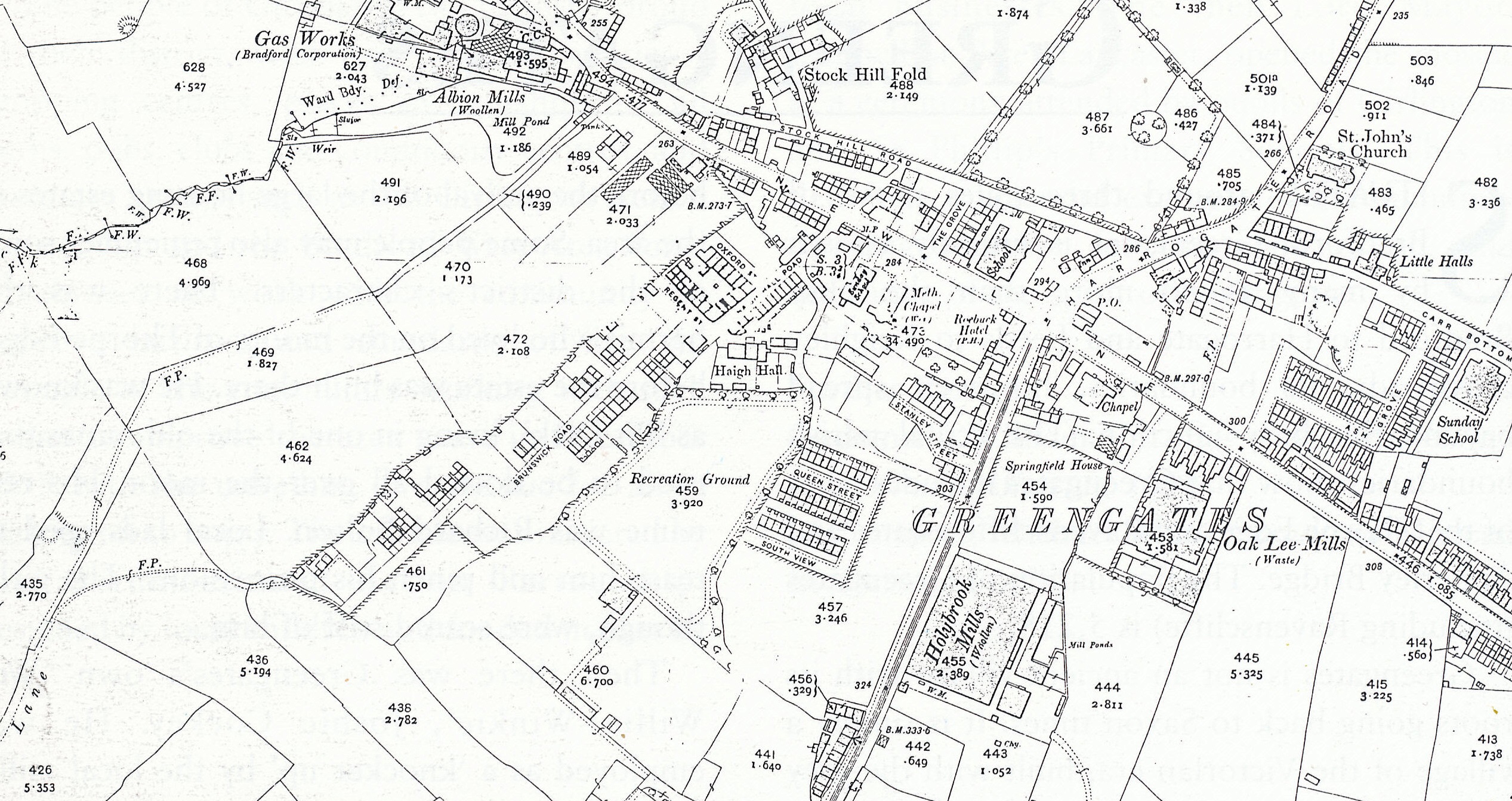
By the mid to late 19th century, Idle, like much of the Bradford district, was heavily involved in the textile industry.  A look at the Ordnance Survey map of 1893 shows many mills in the area, including Castle Mills, Union Mill on Butt Lane and the nearby New Mills.  By the 1870s around 1,100 people from Idle were employed in the township’s mills. Idle seems to have achieved some kind of parity in the size of the mills that operated there.   Cudworth states that no giant manufacturer dominated the neighbouring companies in the village.   Indeed he goes on to say that the villagers of the late 19th century were probably the most ‘equal’ in the entire land, with no man of exalted rank or great wealth residing in the township.  The villagers displayed a prominent love of their home but Cudworth found them rather ‘clannish’ in their attitudes to outsiders.

Another source of income and employment in 19th century Idle was quarrying.  Stone was dug underground from beneath Idle Moor and raised to the surface via deep shafts, so unlike areas such as Bradford Moor with its vast coal mining operations, the landscape was not utterly ruined.  Idle stone was well known and was considered superior to stone from many other areas.  It was used on public buildings in many towns in England, and was even exported as far as China, Australia and South America.  Among those involved in extracting Idle stone in the early 19th century were William Storey of nearby Apperley, William Child of Greengates, and later Thomas Denbigh, among others.

Idle grew rapidly during the 19th century, reflecting an increase in the population of the Bradford district as a whole.  In 1801 the township’s population had been around 3,400, yet by 1871 it had risen to over 12,000.

At this time the village itself was well established, along lines that are easily recognisable today.  At the top of the village, on Towngate, the Old Chapel of Ease, which was erected in 1630, was still in its original use.  The chapel came by its name due to the fact that the nearest parish church was at Calverley, quite a trek away, so the chapel was quite literally built for the ease of the people of Idle.  The building currently houses the highly successful Stage 84 drama school.  Adjoining the Old Chapel was the township’s lock-up, complete with stocks.  On the opposite side of Towngate and a little further down stands Holy Trinity Church, built in 1830.  Just across from the church is the former library building, a large Victorian structure which seems to loom over the road.

The rooms above the library were latterly used as meeting rooms for local clubs and societies but were once used for meetings of the Idle local board, which oversaw the township’s affairs. The library moved into former shop premises in a more centralised location just below the Green in the early 1990s.

Idle can aptly be described as a village of two halves.  First there is the top half, centred around High Street, which runs steeply downhill from Highfield Road to the Green, from around which the bottom half of Idle radiates.  It was at the junction of Highfield Road and High Street that workmen making road improvements uncovered three ancient cellars.  The discovery, in 1987, caused much excitement in the local community, and it was suggested that the cellars offered proof of the location of the old Manor House, lost to historians for many years.  The proof of this theory may never now be tested as the cellars, which may have had underground passages running to Holy Trinity Church, were subsequently filled in.  High Street is also home to the wonderfully named Idle Working Men’s Club.  The club has found international fame due to its name and has boasted celebrities such as jockey Lester Piggott and Tom O’Connor among its honorary members.

idpic2

Idle Working Men’s Club

The bottom half of the village still boasts an array of small local shops, but the lure of nearby supermarkets with their cheap prices has inevitably caused something of a decline.  In its heyday Idle had its own railway station and cinema, both now long gone.  The station was on the line between Laisterdyke and Windhill, which opened to passengers in April 1875.

Sadly there is now little evidence left of the railway line that neatly bisected the village, reinforcing the division between upper and lower Idle.

Idle today is a busy, well-populated suburb of Bradford.  Smart, early 20th century housing lines Highfield Road, and a modern complex of flats stands on Bradford Road, at its junction with ldlecroft Road. The village itself has many excellent facilities for its residents to enjoy.  Small shops around the Green almost give the centre of Idle the appearance of a Dales market town. Idle boasts its fair share of pubs – the New Inn and the White Bear at the very top of the village, the Alexander and the Brewery Tap down on Albion Road, and the White Swan, which stands on the Green, to name but a few.
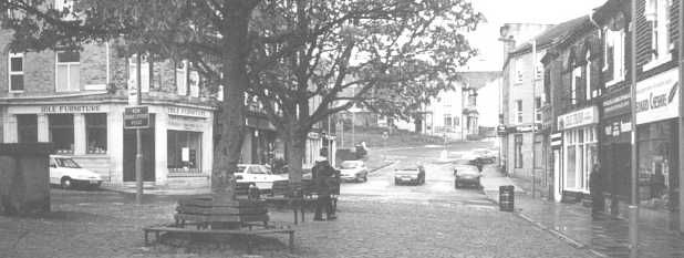
idpic3

The Green, Idle

The village has two supermarkets within easy reach, and a new medical centre was built on Highfield Road in the early 1990s, and the village has numerous clubs and societies to occupy its residents.

Like many of Bradford’s other suburbs then, Idle is a popular, pleasant place to live, offering all the trappings of modern living, yet retaining something of its historic appearance and charm.  This is most definitely one part of Bradford that doesn’t live up to its name.

Further Reading

Cudworth, William. Round About Bradford, 1876. (Reproduced 1968, Arthur Dobson Publishing Co.)
Watson, W.  Idlethorp, 1951.
White, E. Idle Folk Idle & Thackley Heritage Group, 1995.
White, E. Idle, an Industrial Village Idle & Thackley Heritage Group, 1992.

Wibsey

Wibsey sits to the south-west of Bradford, at the top of one of the hills leading out of the city. The village actually stands at quite a height. Looking at an Ordnance Survey map, the 850ft contour line passes through the roundabout at the top of St Enoch’s Road and the land rises to 975ft at Beacon Hill. This must be one of the highest extensive urban areas in Britain. The population in 1991 was 5,357.

The village was mentioned in the Domesday Book as Wibetese. At that time the manor was granted to Ilbert de Lacy by William the Conqueror. The origins of the village name are still uncertain. It has been suggested that the name is an adulteration of “Wigbed’s Land” or “Wigbed’s Height”.

The manor of Wibsey at that time had a common, and the village was surrounded by the Forest of Brianscholes. This was a dense, dark place which offered cover to wild boar and even wolves. Villagers had to have their wits about them on dark nights.

The monks of Kirkstall Abbey  established the famous Wibsey horse fair. Drovers came here from all four corners of the British Isles to buy and sell horses. The fair’s heyday seems to have been at the start of the 20th century, before the start of World War One. Horses were run along Fair Road, Folly Hall Road and Reevy Road.  Additional markets selling various goods spread down Market Street, High Street and Smithy Hill, and even into the fields to the south of the village. You could buy anything from pots and pans to the famous Wibsey geese. There were also traditional fairgrounds, spectacularly lit at night. Much safer to wander around at this time than when the village was surrounded by the forest. The fair usually lasted from 5 October to 20 November. The final day was known as the ‘Ketty Fair’, on which all the horses and animals in poorest condition were sold off.

Wibsey Slack was home to the famous geese. They used to roam here quite freely and unconfined. It used to be regarded as a sign of impending bad weather if the geese left the slack and wandered into the actual village.

One of Wibsey’s most pleasant areas is its park. It is around 30 acres in size and was opened on 25 May 1885, after a grand ceremony. It has always been a popular recreational area with locals. There are sports pitches, a lake, flower gardens, children’s areas and an aviary. The park was once home to a strange attraction. In the 1930s visitors to the park were invited to relax in a ‘sitting room’ sculpted from plants and hedges. This novel arrangement was one of many sculptures produced by the first park keeper, James Walton.

Wibsey Park was built on Wibsey Slack. The area was to be enclosed by the lords of the manor in 1881, but a local councillor, Enoch Priestley, fought against this for the rights of the local people. The land was saved and the park created. Enoch Priestley became a local hero. He also campaigned for a new road linking the village to Bradford. When the road was completed Priestley was unofficially canonised by the locals. They named the road St Enoch’s in his honour.

Wibsey has had a varied industrial history. It was a popular coal mining area, though it seems the coal was of poor quality and was only mined near the surface. The Industrial Revolution arrived here in 1836 with the opening of the first mill. One of the famous characters of this time was Joseph Hinchcliffe. He ran the Horton House Academy and in 1826 started up a Sunday School in the old chapel on Chapel Fold. The school had over 100 pupils and helped boys and girls whose religious instruction would otherwise have been neglected.  Hinchcliffe carried out his teachings until ill health forced him to retire in 1834. However, no one came forward to replace him in the Sunday School, so rather than let the children down, Hinchcliffe decided to carry on teaching them from his home at Horton House. He was also a generous man. Every Christmas he treated the children to a Christmas dinner and each winter he would go round to the homes of the more needy boys and girls and instruct their parents to buy them new clothes at his expense. A true Samaritan of his day!

Today Wibsey is a popular commuter suburb for the city. The past seems to rub shoulders with the present here. Cobbled streets and ancient cottages still exist, many bearing the dates of when they were built. Wibsey has its modern face too. It has a thriving nightlife, based on the  pubs on the High Street, such as the Ancient Foresters, Swan and the Windmill. People travel from all over Bradford and from further afield, for a night out here. The village has all the shops and services you could wish for, mostly situated along the High Street. In fact you could live here quite comfortably without ever having to visit Bradford. This has helped Wibsey maintain a ‘village’ feel, even though it is only a few miles from the city centre.

wibhs

Wibsey High St. c.1900

wibhs2

High St. 2002

This information was taken from “The Illustrated History of Bradford’s Suburbs“, by Birdsall, Szekely and Walker

Clayton – An ancient settlement

Clayton was ancient settlement and was mentioned in the Domesday Book.   It was part of the Manor of Bolton, under the control of Ilbert de Lacy.   At that time it was known as ‘Claitone’, meaning ‘clay soil’.   When Clayton ceased to he part of the Manor of Bolton, it was split into three parts: Clayton Village, Clayton Heights and Cockan, a now non-existent village which lay to the southwest of the present village.

Between 1160 and 1316, Clayton belonged to the following Lords of the Manor: Hugh Stapleton, William de Stapleton, Jordan de Birill and Hugh de Leaventhorpe. It was then acquired by the Bollings in 1324. The Bolling family. and their successors the Tempests, held the Manor of Clayton for nearly 300 years, until it descended to the Lacies of Cromwell – Bottom by marriage.  After the Lacies sold the manor  around 1740, it passed through many hands until 1894, when the district council was formed. The council fought off an attempt by Bradford Corporation in 1898 to amalgamate Clayton with the city of Bradford, and for many years the villagers enjoyed their independence. Inevitably though, in 1930, Clayton finally become part of the city of Bradford, much to the reluctance of many of the residents.

Up until the end of the 19th century, Clayton was almost all green land with very few buildings indeed.  Looking at maps from 1893, it was only a very small village surrounded by fields. In the early 20th century much development took place but the village still had its green belt surrounding it.  Even today, Clayton is separated from its nearest neighbours by fields. It must be a ramblers’ paradise. One can walk to Thornton. Queensbury and even Ogden reservoir through the fields and across moors.

Prior to 1878, when the railway station opened, the only means of transport to and from the village would have been by foot or horse. The station was on the Bradford, Halifax and Keighley branch of the Great Northern Railway, and was situated on Pasture Lane. This meant that it was only 12 minutes to Bradford via rail and only 23 minutes to Halifax. Quicker than driving today it seems. The branch line Closed in 1955 and the entrance to the Queensbury Tunnel was blocked and sealed up.

The railway might have mode it easier for residents to leave the village, but there was not actually much need for this. Clayton was quite self-sufficient.  Many shops had opened in the Clayton Lane area. In 1900 there was a draper, grocers, newsagent. shoemaker, beer retailer, butcher, milliner, confectioner, builder and even a clogger.

One of the focal points of todays village is Victoria Park. The park actually originates from the old village green. In 1897, a meeting of residents was held at which it was proposed that the village green and surrounding land be purchased to form a park.  It was suggested that the park be created for Clayton residents to use forever, and donations were collected so that the project could succeed without any cost to ratepayers, although the park’s upkeep would be paid for by the rates.  The scheme was started in commemoration of the Diamond Jubilee of Queen Victoria and the park finally opened on 23 July 1898. It was opened by Asa Briggs, the highly respected Clayton philanthropist.

The roundabout in Clayton is home to the “wells”.  The wells were stone troughs which supplied water in days gone by.  Householders without water supply would bring their own buckets here to fill up, and carters on their way to Queensbury or Thornton would stop here to let their horses drink. The area was a popular meeting place in times past.

clay2 clay

One of Clayton’s biggest claims to fame is that it was the birthplace and home of Albert Pierrepoint, Britain’s last ‘Number One’ official hangman. In his role as state executioner Pierrepoint dispatched some of the country’s most notorious convicted murderers – while expressing some personal reservations about the value and use of capital punishment.

Alfred Wallis was a well-known and respected Claytonian. He started business in Oak Mills in 1860, with Asa Briggs and Joseph Benn. He was active in Clayton’s affairs for many years and he set up the Alfred Wallis Trust Fund, which can still be used today for the further education of Clayton’s young people. Another of the area’s characters was known as the ‘Clayton poet’. Sherwin Stephenson was born in the village in 1881. He became a talented poet, describing his experiences and life in Clayton. He penned such verses as; `Bonny Clayton’, `Teah Pot Spaht’, ‘The Old Brewery, Clayton’, ‘Cote Fields’ and ‘My Native Hills’, all celebrating the people and surroundings of Clayton. He even described the wells as a meeting place of the ‘Clayton Parliament’. A true ambassador for the village, Sherwin died in 1954. He is buried in Clayton churchyard, where his headstone resembles an open book.

Stephenson’s poems are a perfect reminder of how Clayton used to be. The village will never be the same again, but it is one of the few areas of Bradford which has retained its character somewhat. Stephenson would be proud.