Map of the week: A track into history

I’m not really a railway enthusiast so I must start with an apology to those readers who are, and say that I would welcome your guidance. I don’t find the early history of Bradford’s rail links an easy topic since the companies involved seem to change their names, and move the location of their stations, quite frequently. Naturally the creation of early railway lines generated maps and plans, many of which have survived. Even here I have a problem since tracks appear on maps which are notionally of an earlier date. Despite these difficulties I want to describe the early lines entering Bradford from the south because of  the interesting light they shed on the city’s industrial past.

Map of the Week 30 A

The first image is a detail from the 1852 Ordnance Survey map. It shows Bowling junction, although this is not named. Two, seemingly single, rail tracks, are mapped. The first is the Lancashire and Yorkshire Railway line which connected Halifax to Bradford, and its terminus Drake Street (later Exchange) Station which opened in 1850. The second line moving off to the right went from Bowling junction to Leeds, via Laisterdyke, and was opened a few years later in 1854. It was operated by the same company and, I presume, allowed trains to travel from Leeds to Halifax direct, by-passing Bradford completely. The track no longer exists but the line is visible on aerial photographs.

I am interested that at the junction a ‘limestone quarry’ is mapped. Limestone strata do not reach the surface in the city area but there was nonetheless an early lime-burning industry based on the extraction of boulders from glacial moraines in the Aire valley. Boulder pits were certainly established in Bingley by the early seventeenth century. It looks as if glacial erratic limestone boulders were found elsewhere, being exploited in the same way. In this case the digging of a railway cutting presumably exposed the valuable mineral. Plausibly these boulders were taken to the nearby Bowling Iron Company where crushed lime was used as a flux in iron smelting. Slightly further north is Spring Wood. The name has almost certainly nothing whatever to do with a water supply. ‘Spring’ was applied to a tree that had been cut off at ground level for coppicing. So Spring Wood was presumably an area of old coppice woodland. William Cudworth records that there was once also a Springwood Coal Pit, but the wood itself soon disappears from maps.

Map of the Week 30 B

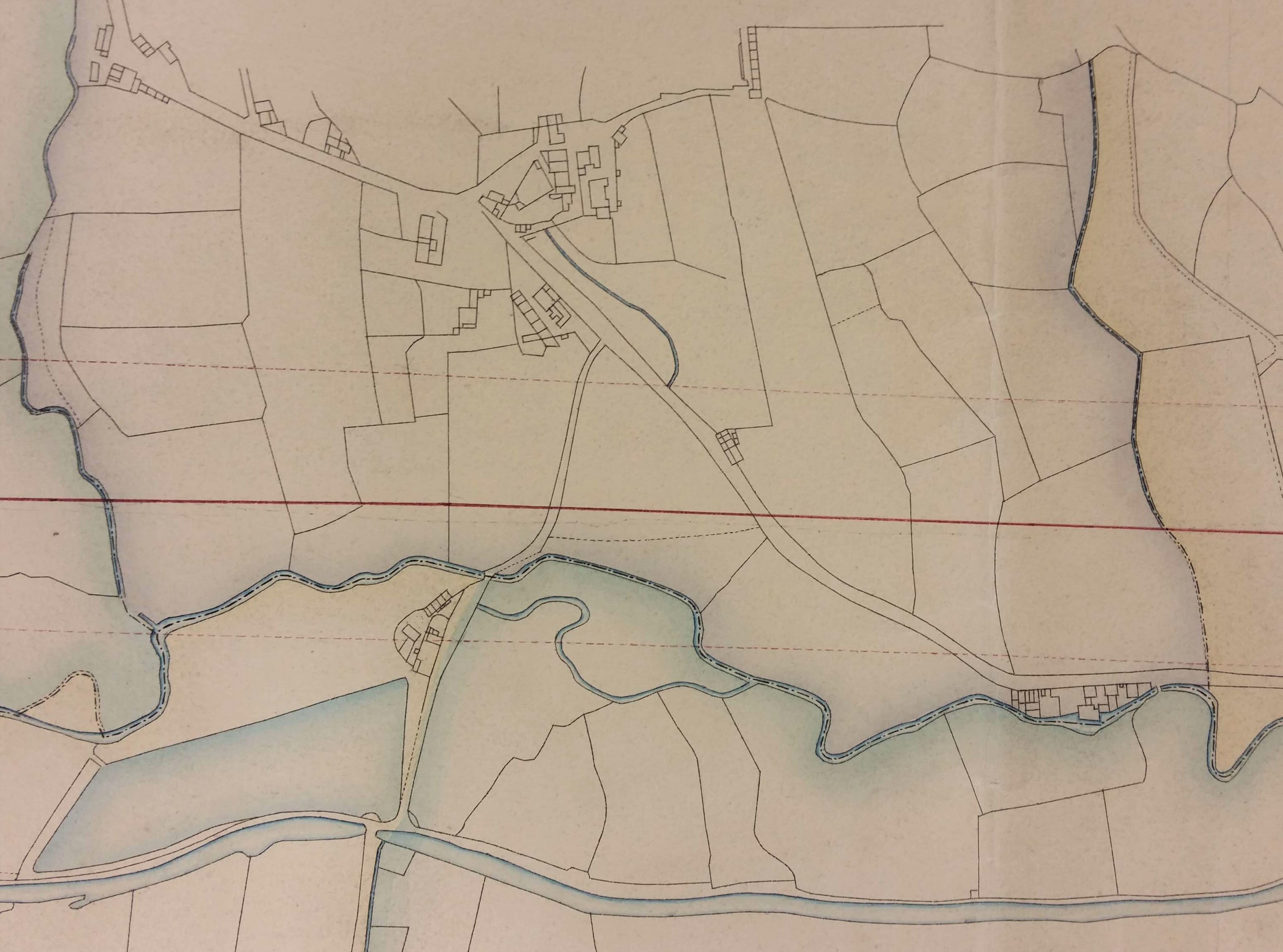
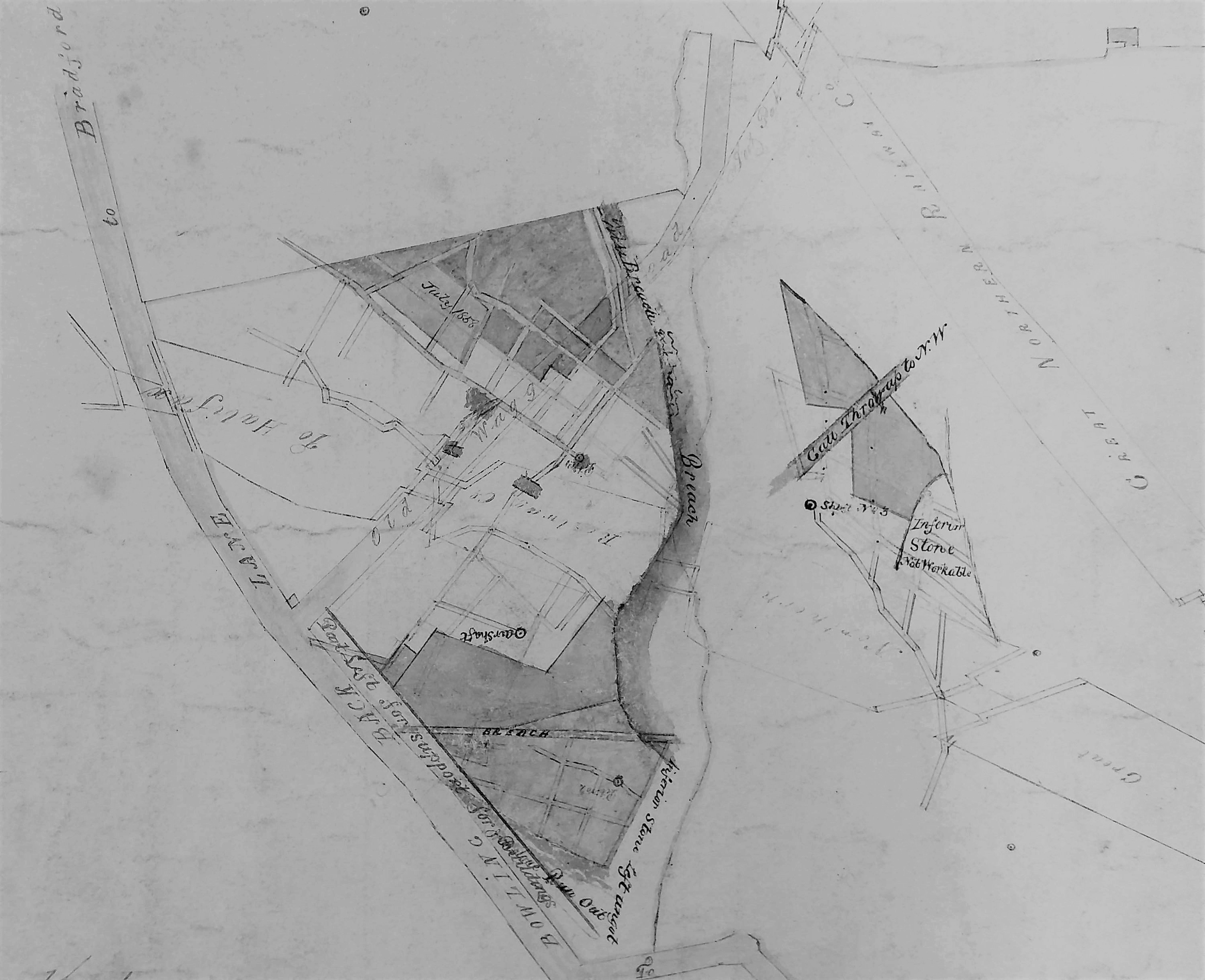
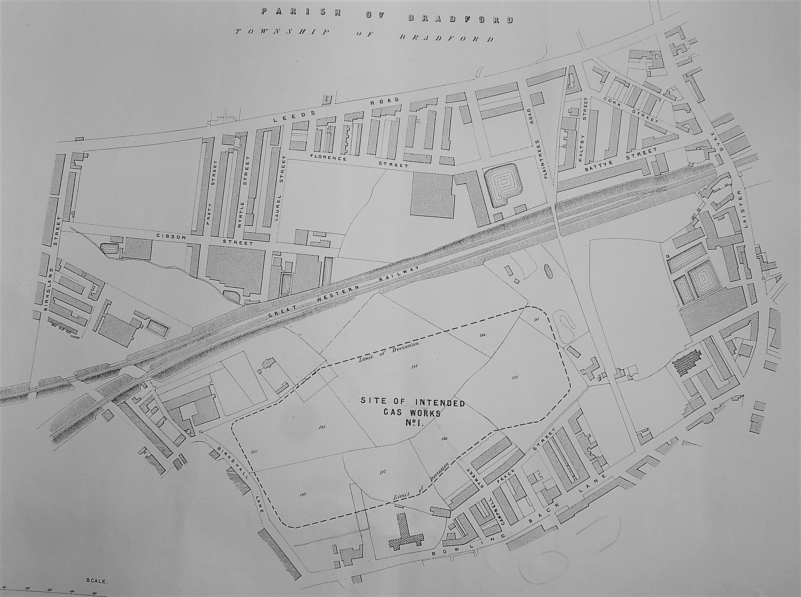
The next plan is from the Local Studies Library reserve collection. If you imagine it turned 90º  clockwise it is clearly the same view as before. You can easily identify the two railway tracks and also the Bowling Dye works. The name of the company involved here is West Riding Union Railway. As I understand it this title was only employed for a brief period around 1845-47. This and other evidence suggests that this map is a few years earlier than that of the OS map we have examined. This map shows the Bowling Iron Company colliery tramway very clearly. This took coal to the Bowling Depot on Queens Street where I assume it was available to local merchants. The Bowling Dye Works and the Bowling New Dye House were both parts of the Ripley family enterprises (Edward Ripley & Co). What are obviously missing are the large reservoir and dye pits which are such a prominent feature in the OS map. When were these created? The Bradford Observer reports a large sale of land in this area, including that piece accommodating the Dye Works, in 1850. The vendor isn’t stated but might well be the Bowling Iron Company. Probably the dye works boss, the famous Sir Wm. Henry Ripley, purchased land at this time to allow for the expansion of his business and the assurance of adequate soft water supplies, which included a reservoir. Cudworth records a 100 acre purchase by the Ripley company and also states that a contractor called Samuel Pearson constructed reservoirs for Bowling Dye Works and Bowling Iron Works at a date ‘early in the fifties’. We shall hear more of Samuel Pearson shortly. Marked on this map are marked a variety of planned new streets. Were these streets ever constructed? Presumably not. After 1863-64 Ripleyville, consisting of 200 houses with schools, was constructed by Sir Henry but the alignment of these streets on the 1887 borough map looks quite different.

Map of the Week 30 C

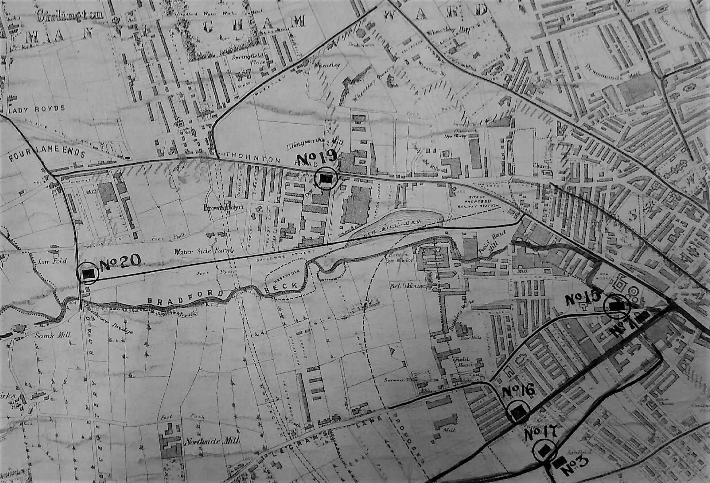
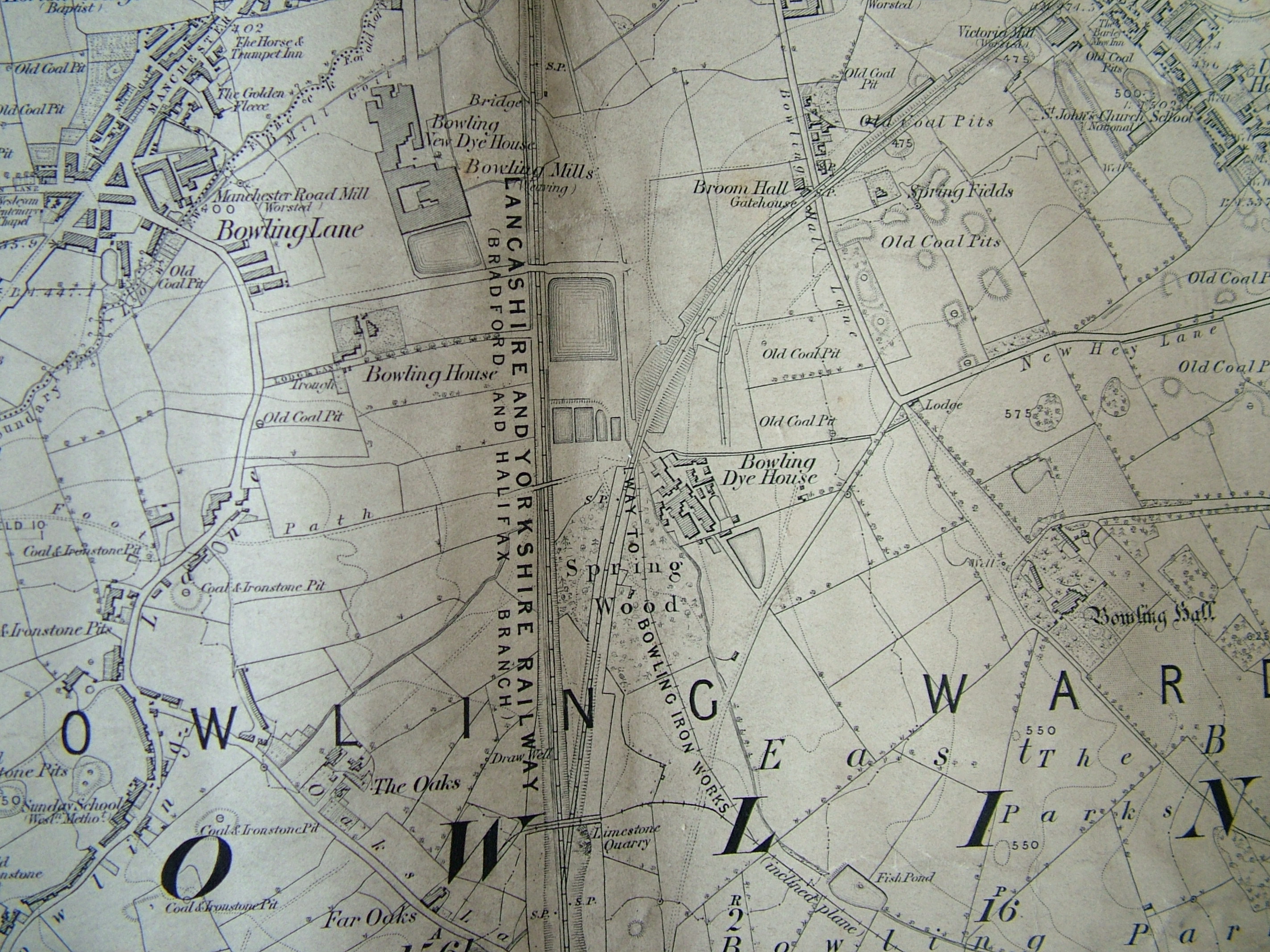
This third map shows an area slightly further north. There have been additional train track developments. The Great Northern Railway had opened its service to Leeds from Adolphus Street station in 1854 but the rival Midland Railway service, via Shipley, ended at a station more convenient to the town centre depriving GNR of customers. In consequence, around 1867, a track loop was constructed connecting the GNR line to the L&Y track at Mill Lane junction and allowing passengers from Leeds access to Exchange Station. Nearby St Dunstan’s passenger transfer station was also opened. The loop is clearly visible on the map north of Ripleyville. In describing the work involved in taking the GNR railway line from the Exchange Station towards Leeds, Horace Hird (Bradford in History, 1968) again mentions the activities of Samuel Pearson & Son who took over responsibility for the material excavated from the necessary cutting. The cutting spoil created a ‘great mound’ and for 15 years 60 men were employed making drain pipes, chimney pots and bricks from this material. Their Broomfield brick works is clearly indicated on the map above the loop. The line seen curving away to the left edge of the map, opposite the brick works, services a series of coal drops which are still visible, in a ruinous state, off Mill Lane today.

Samuel Pearson was a Cleckheaton brick-maker who founded a contracting dynasty. His contracting business started in Silver Street, off Tabbs Lane, Scholes, in 1856. By 1860-63 Messrs. S. Pearson & Son were established at the Broomfield Works, Mill Lane (near St Dunstan’s) for the manufacture of building bricks, sanitary tubes and terracotta goods. The works can be identified on the 1871 map of Bradford but closed shortly before the 1887 map was published, the ‘spoil bank’ being exhausted. The site is described as a ‘disused brick-works’ by the time of the 1895 OS map. Within a generation Pearson’s had became an international contractor and was particularly associated with Mexico during the dictatorship of Porfirio Diaz. Canals, railways and oil were among the company’s many interests. After being created a baronet Samuel Pearson’s grandson, Weetman Pearson, became the first Viscount Cowdray in 1917. The family seat became Cowdray House and park, near Midhurst in West Sussex.

map-of-the-week-30-d.jpg

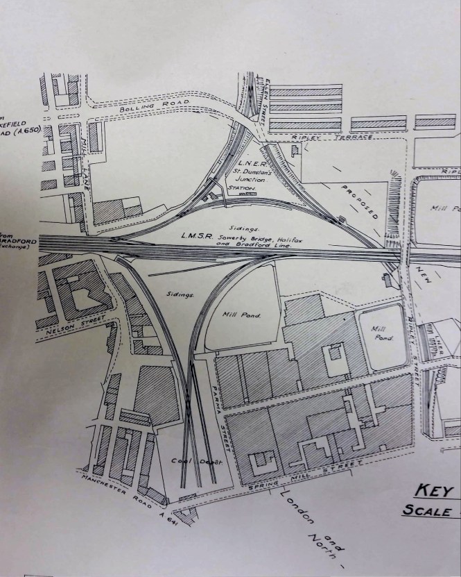
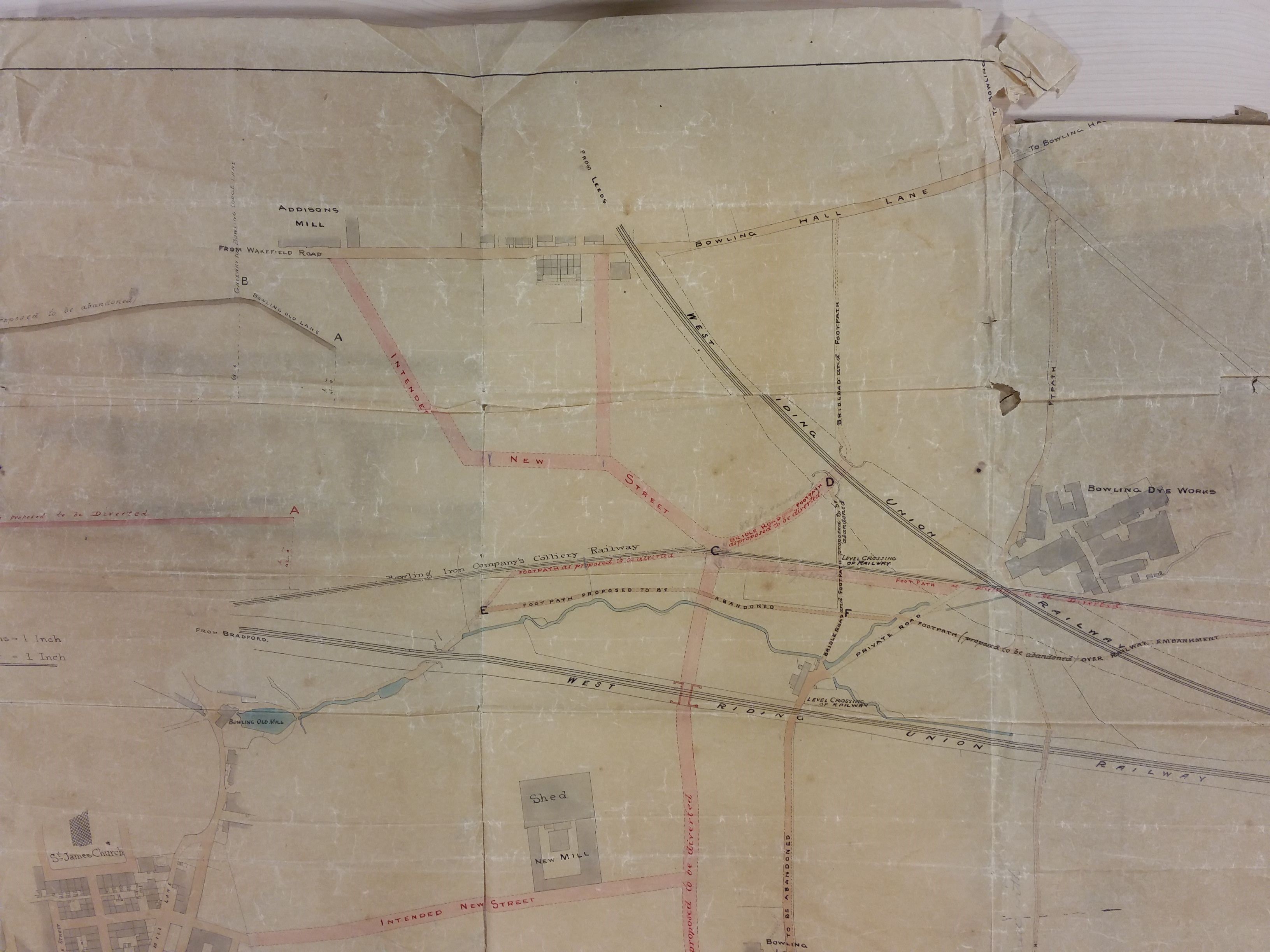
For the final plan I return to the LSL Reserve Collection. Essentially it shows the same area as the last. The plan is undated but the railway companies have their pre-nationalisation names, so it is earlier than 1948. Wakefield Road is referred to as the A650 and local historian Maggie Fleming suggests that this nomenclature makes the plan later than 1920. St Dunstan’s Station is still present, and in fact had another thirty years of life before closing in 1952. The site of Broomfield brick works is blank, and is today a car park. The purpose of this plan seems to have been to show the course of a new road joining Bolling Road to Upper Castle Street. This is another thoroughfare that was never constructed.


Derek Barker, Local Studies Library Volunteer


Map of the week: Old Frizinghall

Bradford local historians are most fortunate in having the Local Studies Library and the West Yorkshire Archives (Bradford) under the same roof, each with helpful and dedicated staff. To illustrate the value of this I shall trace the history of a single building starting with the Local Studies Library reserve map collection which provides a detailed plan of the area between Bradford and Shipley. The plan is completely unlabelled but field boundaries and properties are meticulously drawn. A detail is included here which shows the canal and Bradford Beck at the bottom. A continuous line (red in the original) near the map centre must represent the railway to be opened by the Leeds & Bradford (later Midland) Railway Company in 1846. The discontinuous lines lines on either side were presumably an estimate of the land needed to be acquired by the company. The date of the map would be the early 1840s. From comparison with the first OS map of the area, surveyed a few years later, the track did follow exactly this route.

Map of the Week 029 A

You would need to know this area very intimately to recognise the hamlet in the upper centre of the map as Frizinghall. This is now considered to be part of Heaton, which was not incorporated into the Borough of Bradford until 1882. To orientate yourself imagine you are standing in Bolton Woods: the direction of Bradford is to the left and Shipley to the right. The course of the beck has since been straightened and between it and the railway is the modern Canal Road, at roughly the position of the lower interrupted line. The thoroughfare drawn crossing the canal is Gaisby Lane. The next plan is a detail from a lovely Frizinghall map which is approximately contemporary with the first image. It is available in the LSL main collection.

Map of the Week 029 B

There was to be extensive house building over the next 50 years, probably after Frizinghall train station was opened in 1875, but many features on this map are still visible today. The three buildings in the lower third certainly still exist. The only one with public access fronts the turnpike road. This is the Black Swan public house; the triangle of land on which it sits was once called Swan Hill and is well above road level. The Black Swan must predate even this map by several centuries and is well worth a visit. From its car park the housing which looks like a laterally inverted L is also visible. The third building in the cluster is a private house then called the Old Hall.

 My personal favourite is the building in the middle of the blue coloured land opposite the ‘turn’ of turnpike; this is still easily visible from the road. Although latterly called ‘The Old Barn’ when it was a pub-restaurant, the property was known as ‘The Poplars’ for much of the twentieth century. Earlier than that it was ‘Carr Syke Farm’ or ‘Lower Carr Syke Farm’. The Carr Syke was a watercourse, the name deriving from the Norse meaning ‘the stream in the marshy ground’. In the late eighteenth century the Carr Syke Farm seems to have formed part of the estate of Benjamin Hird of Frizinghall which was sold to a Dr Joshua Walker of Leeds in 1795. The estate passed to Dr Walker’s daughter Margaret, and then by marriage to a well-known Quaker, William Leatham of Hemsworth Hall, Wakefield. I believe it was owned by his family for the next 80 years. In 1883 the property was then sold to Bradford Corporation by William Henry Leatham and others. Two years later the property was purchased from Bradford Corporation by the Clockhouse Estate who retained it well into the twentieth century. Much of this portion of the estate eventually became the location of Bradford Boys Grammar School.

If you wish to learn even more a distinguished local historian, Lillian Robinson, wrote a detailed account of Frizinghall (the place of her birth) in the years 1973-75. This work does not seem to have been published but typescript copies are available in the Library (B942 ROB). The notes on which this work is based are available in the Archives (WYB140) and are as useful as the completed work itself. Earlier still M. Blundell Heynemann had written an account for The Heaton Review in 1931. She had this to say: ‘on the right, down a paved path, is the entrance to the Poplars, the residence of Mr Wilkinson, the Clock House Estate Agent. A farm, now demolished, formerly stood facing the road and only the old barn and stables still remain. It was farmed by a Mr Greenwood who went there in 1877’. The Bradford historian Cudworth clearly mentions, without directly naming, Lower Carr Syke Farm because of its association with William Wilson who once leased it: ‘another old homestead at Frizinghall, enclosed in its own grounds, was for some time the residence of a most exemplary Quaker family, named Wilson, originally of Esholt. One of the members of this interesting family, named Willie or ‘Quaker’ Wilson (1767-1849), enjoyed a reputation throughout the entire kingdom for his many eminent qualities as a philanthropist.’  Wilson was apparently able to retire at fifty years of age (that is in 1817) with a fortune of many thousands of pounds. This he methodically gave away to the poor over the next 30 years. He died, much lamented, in November 1849, aged 82, and his remains were interred in the Friends’ burial-ground, Bradford.

With the next two images the Archives comes into its own. Both are rotated 90° anti-clockwise from the first two. We have moved back a generation to Joshua Walker Sr. (1713-1801) who was also a Bradford Quaker, and an apothecary; he seems to have been an amateur architectural enthusiast who drew many house plans. It was his son, Dr Joshua Walker (1746-1817) physician at Leeds Infirmary, who had bought the Carr Syke estate. One of his father’s undated plans, available in the Archives, is labelled ‘Lister Patience’s Farm’; Heaton & Manningham’. The field boundary pattern fits Lower Carr Syke Farm. In this plan the present building would appear to be originally a barn which has two cottages (now missing) in front of it.

Map of the Week 029 C 

Another of Joshua Walker’s productions, WYA(B) 85D90 plan 45, is described as showing a ‘laithe house and yards’. There’s not much doubt that Lower Carr Syke Farm would have appeared very much like this when first arranged for human habitation. It is quite possible that the drawing does actually represent Lower Carr Syke Farm itself. The two cottage-like structures in the foreground could easily be those marked on the map of ‘Lister Patience’s farm’. I have not been able to trace ‘Lister Patience’, nor Patience Lister which sounds a more probable name. Can anyone help?

Map of the Week 029 D


Derek Barker, Local Studies Library volunteer

Map of the Week: Toads and Chapels

In the 170 years since Bradford became a borough, in 1847, its centre has changed almost beyond recognition. New buildings have been erected and old ones demolished. The Bradford Beck has progressively vanished underground into culverts.  New roads have been created (Sunbridge Road being a good example), while others have been repositioned, lengthened, or have disappeared entirely. Change has been a continuous process but it was accelerated in the 1960s when there was a wholesale city centre redevelopment associated with the name of SG Wardley, the City surveyor and engineer. I should like to recount something of this story by describing the events that befell a thoroughfare called Chapel Lane.

Map of the Week 028 A Final

Image 1

I thought I had made a good start with the this first plan, which is widely reproduced and purports to date from 1800. Here it is easy to see the acute angle made by the Turls (Tyrrel Street) and Chapel Lane/Toad Lane. Toad Lane is an odd name but it is not unique; there are, or were, Toad Lanes in Bingley, Newark and Rochdale. Possibly the name is a corruption of ‘t’owld’ lane: certainly in Bradford the lane is drawn, but not named, on a map as early as c1722. On the above plan building (3) is the Unitarian Chapel which was certainly in existence at this time. An existing town hall is numbered (35) on the map but there is a small puzzle here. The Act of Parliament that appointed commissioners for levying rates, and improving Bradford roads and lighting, was only passed in 1805 and no town hall was to be built for decades. I am very obliged to local historian Kieran Wilkinson who explained this apparent anomaly by telling me that the map of 1800 is not contemporary but was a creation of the late nineteenth century, and marked places both where important local buildings were in 1800, and would be in the future. Let us instead look at a detail from a map that is believed to be contemporary, that of 1802, which is available in the Local Studies Library.

Map of the Week 028 B Final

Image 2

I do not think that there is much doubt that the second plan was the origin of the first, but there are some difficulties here too. Firstly Toad Lane is not mentioned. Kieran tells me that the shortening of Toad Lane, to that unnamed portion that leaves Chapel Lane at a right angle to join Bowling Green, happened in August 1804. The town’s board of commissioners changed both it and the names of a number of other roads in the town (Bank Street, Bridge Street, Market Street and Well Street being introduced as names then). Secondly although there is a Chapel Lane there is no obvious chapel. In his Pen & Pencil Pictures of Old Bradford William Scruton gives a full account of this building, originally constructed in 1717. Much of its material came from Howley Hall, Batley and the land on which it stood was donated by the Sharp family of Horton Hall. The names was originally the Toad Lane Presbyterian Chapel. The old chapel lasted about 150 years and for much of this time was located ‘amid green fields’. The chapel was replaced by a larger more modern structure in 1869, and finally demolished a century later. The most notable figure to be connected with the institution was Rev. Joseph Dawson who is closely associated with the exploitation of the mineral wealth of Low Moor. One possible explanation of the difference between the two maps is that the 1800 marks the position of the 1869 rebuild whereas in 1802 the chapel formed part of the block drawn immediately south of the first section of Chapel Lane. Unfortunately this simple explanation cannot be correct. A chapel, but with no denomination provided, is mapped here c1722, which is in accordance with Scruton’s statement, and the following detail from a map of 1825, surveyed by L Atkinson, clearly illustrates the same building. Here the building numbered (8) is identified on the map rubric as the Unitarian Chapel.

Map of the Week 028 C Final

Image 3

I have already mention the Bradford commissioners. This early embryo town council are said to have originally met at the Bull’s Head Inn, Westgate. At the first meeting according to historian Horace Hird, Lord Mayor (1951-52), the commissioners drew up that list of Bradford roads. The same commissioners moved to the ‘Station House’ in Swaine Street after it was erected in 1838. They did not change landlord since the Bull’s Head and the Station House were both built on land leased from Rev. Godfrey Wright who regularly features in this articles.  The final building I want to mention is the Bowling Green Hotel, which completes what I shall call ‘the central triangle’. This hotel was located at the end of Bridge Street. Cudworth mentions that in the 1830s its owner was a Mrs Susannah Ward, widow of Joseph Ward. William Scruton pushes the Bowling Green’s existence still further back into the seventeenth century. He regarded it as ‘the best inn of the town’. It was used by the Royal Mail and the open space in front of the inn, which presumably was once a bowling green, came to be employed for political meetings. The road names remain unchanged until the mid-nineteenth century, which is represented by the next map from the Local Studies Library reserve collection.

Map of the Week 028 D Final

Image 4

It is perfectly clear that there has been extensive construction in the central triangle.  The Bradford Observer (1844) observed that the premises of DH Smith at the corner of Toad Lane were ‘striking and elegant’. Elsewhere a ‘Smith’s Tavern and Beer-house’ is noted which I assume was the same building. Other developments were evidently far from elegant. In 1847 the Poor Law Commissioners considered Chapel Lane a possible site for a ‘vagrants yard’, and in 1855 a ton and a half of ‘vile bones’ were removed from the premises of John Boyd. The Lund’s 1856 Directory of Bradford lists John Boyd as a ‘rag dealer’. The same source gives Rev. JH Ryland as the non-resident minister at the chapel. There is also an architects’ partnership (Stott & Illingworth) and a painter (John Edwards), but otherwise the Chapel Lane residents are all tradesmen: plumbers, hair dressers, bootmakers, saddlers, pawnbrokers and so forth. Was the ‘Old Foundry’ (Cliff’s Foundry) drawn on the second map still functioning in the town centre? According to Hird it was.

The new unnamed cut-through joining Chapel Lane and Tyrrel Street  is Bower Gate. Toad Lane makes an acute angle with Norfolk Street. Kieran Wilkinson tells me that Toad Lane was ‘stopped up’ in 1869 to assist with the subsequent Town Hall development. The Bradford Daily Telegraph of 10 September 1873 recalled that Toad Lane was a ‘narrow passage… immediately behind Garth’s warehouse’. According to the Bradford Observer of 17 March 1869, the width of Toad Lane was only three and a half yards. The next development, which I have already hinted at, represented a huge change. Bradford Borough Council decided that a purpose built Town Hall was required to support the rapidly growing urban area. A number of sites were considered but Chapel Lane or the Bowling Green were the front runners. Finally a competition was launched to design a hall to be built on the Chapel Lane site. The winning design was opened by the Mayor, Matthew Thompson, in 1873. The architects were the famous partnership of Lockwood & Mawson who had already designed the Wool Exchange (1867). The contractor was John Ives of Shipley. In his book Bradford in History Horace Hird described the whole process and provided illustrations of the runners-up. It seems that all the considered designs were for Gothic buildings including a tower. The stone for the winning design came from Cliff Wood quarries but at present I do not have sources for the glass, metal work and ornamental marbles, nor the million bricks incorporated into the structure. The Unitarian Chapel and Chapel Lane itself were left alone during this development, but Bradford became a city in 1897 and the increase in council business required an extension to the Town Hall, opened in 1909. This provided more committee rooms and a banqueting hall. The designer was Richard Norman Shaw. As you can see from the map below only a stub of Chapel Lane remained after the completion of this extension, and the chapel is now south of Town Hall Square. A further extension was constructed in 1914 but this does not seem to have affected the plan of the building which is essentially the same in the 1930 OS map with Chapel Lane now opening off Norfolk Street. The nearby Alhambra Theatre was to be built at the same time.

Map of the Week 028 E Final

Image 5

Understandably these events drastically reduced the number of occupants of Chapel Lane. Even before the extension was built the PO 1898 Directory indicates that, besides the city’s conditioning house, health office and water testing department, there were just five textile related premises, and a produce merchant. Chapel Lane and the Unitarian chapel survived until the reorganisations of the late 1960s when wholesale clearances took place. These must have been required to create the space that became Centenary Square, the Magistrates Court and Coroner’s Office building, the Norfolk Gardens and the Hall Ings extension. The court building, which was opened in 1972, retains ‘The Tyrls’ as its address. What remained of Chapel Lane ultimately gave way for Norfolk Gardens. However Kieran feels that it is arguable that some of Chapel Lane remains within the Town Hall as there is an outside area between the original Town Hall and the extension which was part of this lane.


Derek Barker, Local Studies Library Volunteer


Map of the Week 027: What was going on in Great Horton?

If you are reading this article you probably find maps and plans as interesting as I do. You will certainly understand how easy it is to get distracted, while writing a brief report, by trying to identify all the recorded features and resolve some of the inevitable puzzles. The first image is a detail of a map in the reserve collection which is in poor condition. The parent map is the one produced of the Borough of Bradford in 1873 by Walker & Virr, which is especially valuable since it falls evenly between the two first Ordnance Survey maps of the 1850s and 1890s. The twenty years that preceeded the Walker & Virr map brought huge changes to Horton. In 1850 the community had been surrounded by many coal and ironstone pits, both functioning and disused. Tramways conveyed their products to the Low Moor Ironworks for conversion into best Yorkshire wrought iron. By the 1870s the seams were exhausted, the pits were closed, and there had been considerable housing development.

Map of the Week 027 A

A map detail showing Great Horton watercourses and main sewers

This map was in a group that evidently came to the Local Studies Library from the city’s Surveyors and Engineers Department. Its purpose is clearly recorded, this being to record Bradford’s main sewerage system and to show storm overflows. The main sewers collected both foul water and surface water. During a rainstorm they could become completely filled. Under those circumstances the plan was for the excess to flow into alternative sewers and ultimately watercourses like the Bradford Beck; not a pretty thought. The positions of the storm overflows are more easily displayed in a second map detail.

Map of the Week 027 B

A detail from the same map showing sewers in the area between Thornton Road and Legrams Lane

The Borough Surveyor (B.Walker) employed this map. It was clearly being used for at least a decade after its first publication since pencil annotations are dated for the years 1881-83. Having dated the map and identified its use I thought that there were three features of particular interest: the Old Mill, Bracken Hall, and the brick works.

The longer watercourse in the first image is the Horton Beck which provided the water for the Old Mill. A little further down stream, out of sight, was a second corn mill called the New Mill. I assume that the Old Mill started life as a manorial watermill, like Bowling Mill or the Bradford Soke Mill. William Cudworth records that in the nineteenth century the Lord of the Manor of Horton was Sir Watts Horton and then, after his death, his son in law Captain Charles Horton Rhyss. His property came up for sale in 1858 when William Cousen of Cross Lane Mill purchased the lordship. The Old Mill, its farm, and the water rights went to Samuel Dracup a noted textile engineer. He, it appears, eventually converted Old Mill to be a textile mill. I am more interested in an earlier tenant of Old Mill recorded in the Ibbetson’s 1845 Bradford directory, John Beanland. He was the son of Joseph Beanland who was a corn miller and colliery proprietor at Beanland’s Collieries, Fairweather Green. Cudworth says he belonged to a Heaton family. There was certainly a James Beanland (1768-1852), of Firth Carr, Heaton who exploited coal in Frizinghall.

Cudworth describes the impressive looking Bracken Hall as being of a fairly recent origin. I’m sure Cudworth is correct since the Hall is not present on the 1852 OS map of the area. It was inhabited by William Ramsden who was the owner, with his brother John, of Cliffe Mill. This was a Horton worsted mill which can be seen in the centre left of the first map. Bracken Hall was described as being ‘surrounded by a thriving plantation’ which is certainly the appearance that this map records. In the 1881 census William Bracken (54) and his wife Sarah (57) were living at the Hall rather modestly, with only a cook and a housemaid. I am not sure when the house was demolished. It certainly survived into the twentieth century but is missing from the 1930s OS maps. Before the construction of the Hall there were fields and a pre-existing farmhouse which I assume is the small building called Bracken Hill on the OS 1852 map. The land was owned by Mrs Ann Giles who possessed much property in Great Horton including Haycliffe Hill and Southfield Lane with the fields in between. The means by which she acquired her estate was quite complicated. Hannah Gilpin Sharp (1743-1823) of Horton Hall bequeathed her mansion, with all her land in Bradford, to her nephew, Captain Thomas Gilpin and his male heirs, and in ‘default of issue’ to her niece Ann Kitchen. Captain Gilpin, after enjoying the estates for only three years, died at Madeira in the year 1826 without ever having been married. So Ann Kitchen came into the property. In 1828 she married a clerk in Somerset House, as her second husband. Cudworth records him as Edward Giles, but I believe that Edmund is the correct name and the couple were united at St Pancras Old Church. Here their son, another Edmund, was baptised the following year. Ann Giles lived in Tavistock Place but her husband died in 1832 leaving his infant son as heir to the Horton estates. At the age of 25 this son Edmund eventually went to Australia, being enamoured of sea life, but only lived three days after landing in the colony. In 1839 an Act had been passed for disposing of the Giles estate at Horton, owing to the great increase of buildings in the immediate vicinity. Land belonging to ‘Mrs Giles’ are common on maps of Bradford and Horton. In the 1851 census she and Edmund were staying with her daughter by her first marriage, Ann Haines, who was ultimately to inherit her estate.

It seems that I may have fallen at the final hurdle since I cannot identify the owner of the brickworks. In the 1880s Great Horton had no less than three brickworks: Beldon Road, Haycliffe Road and this mapped works in the High Street. The Beldon Road works was owned by the Bradford Brick & Tile Company in the years 1875-1927. The Haycliffe Road works were linked in 1871 with an E.Hopkinson (Wm. Holdsworth manager) and in the years 1875-1883 William Holdsworth seems to be the owner himself. The High Street brick-works was the earliest but its existence may have been brief since it is attested only by maps of 1873 and 1882. It does not feature in the libraries’s stock of Trade Directories. One possibility is that it belonged to Robert Bown ‘coal merchant and brickmaker’ whose bankrupcy was reported in the Bradford Observer in March 1864. Twenty thousand bricks from the ‘Horton yard’ were to be auctioned. A coal merchant of that name lived in Little Horton in the 1861 census. Even if this is true who kept the building going for at least another ten years?

If you would like to learn more about historic Horton I can recommend:

www.bradford.gov.uk/media/2373/greathortonconservationareaassessment.pdf

Derek Barker, Local Studies Library Volunteer.

Map of the Week: Field House Estate

The first two plans preserve a microcosm of industrial life of the mid-nineteenth century, in an area of Bradford not previously examined in this series. The Local Studies Library reserve map collection has two versions of the Field House Estate plan and I have provided a detail from each. They identify the estate as one of the many pieces of Bradford property belonging to the Rev. Godfrey Wright, who has featured more than once in these columns.

Map of the Week 026 A

A:Iron stone workings’ 1858-1860.

Map of the Week 026 B

B: Coal deposits exploited in several years between 1850-1860.

When were the plans originally drawn up? Plan B is actually dated 1847. I  assume both were created in advance of mining to record future areas of ironstone and coal extraction. Perhaps the operator, or Godfrey Wright’s agent, was responsible for them when the minerals were accessed in the decade after 1850. Two shadowy railway lines are clearly visible on both maps. The upper is marked Great Northern Railway Co. with ‘from Bradford’ on the left and ‘to Leeds’ on the right: the Adolphus Street to Leeds Central route then. The lower line is again G.N.R. and is marked ‘from Halifax’ in very poor script on the left, and again ‘to Leeds’ on the right. I am not a railway expert but I assume the second was the Bowling Junction-Laisterdyke line (opened 1854) which must have permitted Halifax-Leeds trains to bypass Bradford. Quite large portions of the line are still visible on modern aerial photographs but the rails themselves have been taken up. The two lines come together just off the plans to the right. From the date of the maps I think we can be certain that the railway information was a late addition, but in any case you can see the railway lines are drawn across the pre-existing field boundaries.

If any reader can immediately identify the correct placement of this area in modern Bradford I shall be very impressed.  It is easier if you mentally rotate the maps by 45 degrees to the left which brings north to the top centre. The road on the left of the plans, running from eleven to five, is Bowling Back Lane. In this section, when corrected oriented north to south, Leeds Road, the Bradford-Leeds railway line and Bowling Back Lane are running roughly parallel. It was probably not a very beautiful area. Cudworth describes Bowling Back Lane as: ‘pretty well cut up with railways and cinder heaps’. It is not easy to link plan features to those on the first OS map of the area which in theory would have been surveyed at about the same time, in the late 1840s. Field House and two associated gardens are represented by the cluster of rectangles in the lower centre of map B. There’s no doubt about the written name although the ‘F’ is difficult to distinguish from the long ‘s’ of house. Field House is much smaller on the OS map. Probably there was demolition when the railway line was created.

At the bottom of map B is a carriage road off Bowling Back Lane which is labelled ‘to Birks Hall’. This road is truncated on map A. Birks Hall had existed at least since the seventeenth century when it was occupied by a member of the Richardson family. Later it belonged to Benjamin Rawson, but newspapers contemporary with the maps seem to suggest that in the mid-nineteenth century it was in multiple occupancy. Notable residents were Letitia Steadman (widow of William DD, of Horton College) who died there in 1837. In 1845-46 William Murgatroyd, who was promoting railway routes, lived there. Nothing of Birks Hall appears on our two plans, nor the associated Golden Fleece Inn. The estate was sold in 1847 and ultimately became the site of a Bradford gasworks in 1877, which remained in use until the arrival of North Sea gas. Plan C was presumably surveyed just before this happened and is from a collection at  Bradford Industrial Museum. It is on a different orientation to the first two but you will see that the left edge of the more modern plan joins the right edge of plans 1 and 2 and a good deal of housing development has taken place here.

Map of the Week 026 C

C: Site of the intended Birkshall Gasworks

The older plans show a total of three tracks leaving Bowling Back Lane or the Birks Hall road and heading north. In the centre is an access way to Field House itself. If I am correct the ‘Old Wagon Road’ was a mineral tramway used by the Bowling Iron Company. In his unpublished account Derek Pickles calls it ‘Golden Lion’ and says: ‘this line was one of the earliest put down by the Company. It ran from the (Bowling Iron) Works, across Bowling Back Lane, along the line of what is now Hammerton Street to coal staithes at the rear of the Golden Lion Hotel in Leeds Road.’  It is clear from the OS map that arches had been created on the railway embankments to allow the tramway to pass beneath them. The third track, Pit Road, as a name which is fairly common in mining areas. This one ran to New Leeds, the name applied to the development immediately south of Leeds Road. Today Birkshall Street and Hammerton Street are in approximately the position of these three tracks.

To examine the two extraction industries shown it is easiest to start on the right of the first two maps with a diamond shaped area. This is evidently underground and is accessed by shafts and galleries. Across it runs a ‘gall’ or throw, that is a geological fault. An area of unworkable material is labelled as coal in one map and stone in the other. Stone must mean ‘ironstone’ although the more common sandstone was mined, as well as quarried, in some parts of Bradford. To the left of this diamond is a much larger, roughly triangular, area of exploitation crossed by a long ‘breach’. I have seen this word before in local mine maps and I assume it represents a larger fault. Plan A shows ironstone working and plan B a much larger area for coal mining. The combination of iron  ore and coal would suggest that the famous Black Bed coal seam was being accessed but a note elsewhere on Plan B helpfully identifies ‘blackbed workings’. Modern borehole reports, from reasonably near the site, suggest that the seam is 20-30m deep. The mined products were surely sent to the premises of the Bowling Iron Company just to the south.

The mining is shown to be extensive, but not unrestricted. In the pillar and stall technique miners left columns of coal to support the gallery roof. Miners could be even more cautious. In Map A a strip along Bowling Back Lane was shown unmined ‘for support for buildings’. The fact that this is being done must indicate that the mined seam is fairly shallow. It is difficult to suggest a date for the conclusion of mining in this area. For one thing I cannot identify the colliery’s name. The first OS map shows a Birks Hall Colliery south of the track to Birks Hall itself, but this is seemingly not part the Field House Estate. Field House does not appear to show any mining activity at all on the first OS map although the 1850 Bradford map shows some ‘old pits’. One explanation would be that the activity on this ground began soon after the OS surveyors had left. The Godfrey Wright died in 1862 and it is possible than the plans were completed because of this event. Wright would never have operated the mines personally, but who did? The Jones Mercantile Directory of the following year lists over 100 coal proprietors and merchants in Bradford which indicates the extent of the industry. In the 1851 census two families live at Field House. The head of one is Abraham Rodgers, 65,  coal dealer employing 30 men. Could he be the colliery operator? I have tried to find out more about him. If he also spelled his name Abm Rogers I can also locate him 10 years later in Wortley when he is a ‘coal miner and proprietor’. Sadly he doesn’t seem to feature in any of the Trade Directories I have consulted which is an unsatisfactory conclusion to the study of these fascinating plans.

Derek Barker, Local Studies Library volunteer