Neglected Bradford Industries: Limestone & lime-burning

Bradford is famous for spinning and weaving but textile production was only one of a group of important industries which ‘Worstedopolis’ supported. Since several  are now almost forgotten by contemporary citizens I should like to draw attention to those which seem unreasonably neglected, in a series of short articles.

Limestone was a most valuable commodity. It could be cut into ashlar for building construction. It could be burned in kilns to produce quick lime which was then slaked with water. In either of these forms it could be spread on the land to ‘sweeten’ acid soils, making them more fertile. Slaked lime was also the essential ingredient of lime mortar, render and whitewash. To charge a blast furnace crushed limestone was added to coke and iron ore because it assisted in the separation of the slag waste. Some hard fossil-containing limestones which took a good polish, like Purbeck stone, were regarded as ‘marbles’ and used for decorative purposes. It is common today to employ limestone aggregate for path and road construction, but this is a relatively recent development.

Limestone consists largely of a single mineral called calcite (calcium carbonate). Immensely thick limestone strata are common near Skipton and in the Dales.  Geologists recognise many sub-types of limestone classified by age, appearance, and fossil content. Since most of the stone reaching the Bradford area was burned we need not be too concerned these complexities.

Image A

Lime quarry at Stainforth, North Yorkshire.

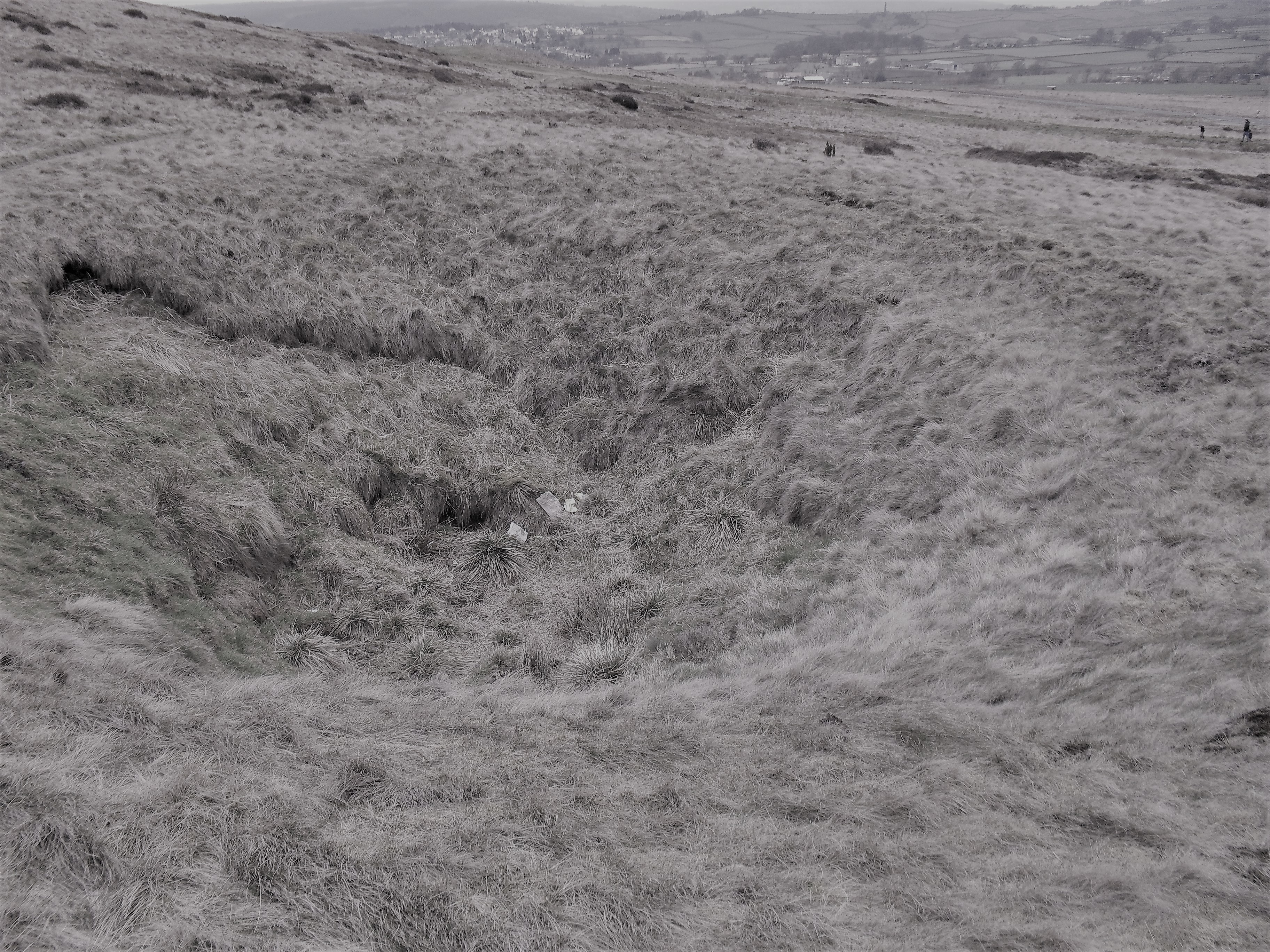
Although limestone strata do not reach the surface in the Bradford area there was nonetheless an early lime-burning industry based on the extraction of boulders from glacial moraines in the Aire and Wharfe valleys. Boulder pits were well established in Bingley by the early sevemteenth century, and three groups of pits are still marked on the first OS map of the area (1852). In 1931 the Bradford Historical & Antiquarian Society published a series of West Yorkshire Deeds which are still available in the Local Studies Library. An indenture of 1604 between Alexander Woodde of East Morton and Abraham Bynnes, with others, mentions the ‘digging of greetstones’. In 1620 Thomas Dobson of Bingley leased four closes of land to his father Michael ‘with authority to dig there for lymestones and to burn, sell and dispose of them’. Glacial erratic limestone found elsewhere was almost certainly exploited in the same way. In the nineteenth century, on at least one occasion, the digging of a railway cutting seems to have exposed similarly valuable boulders.

Image B

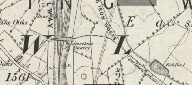
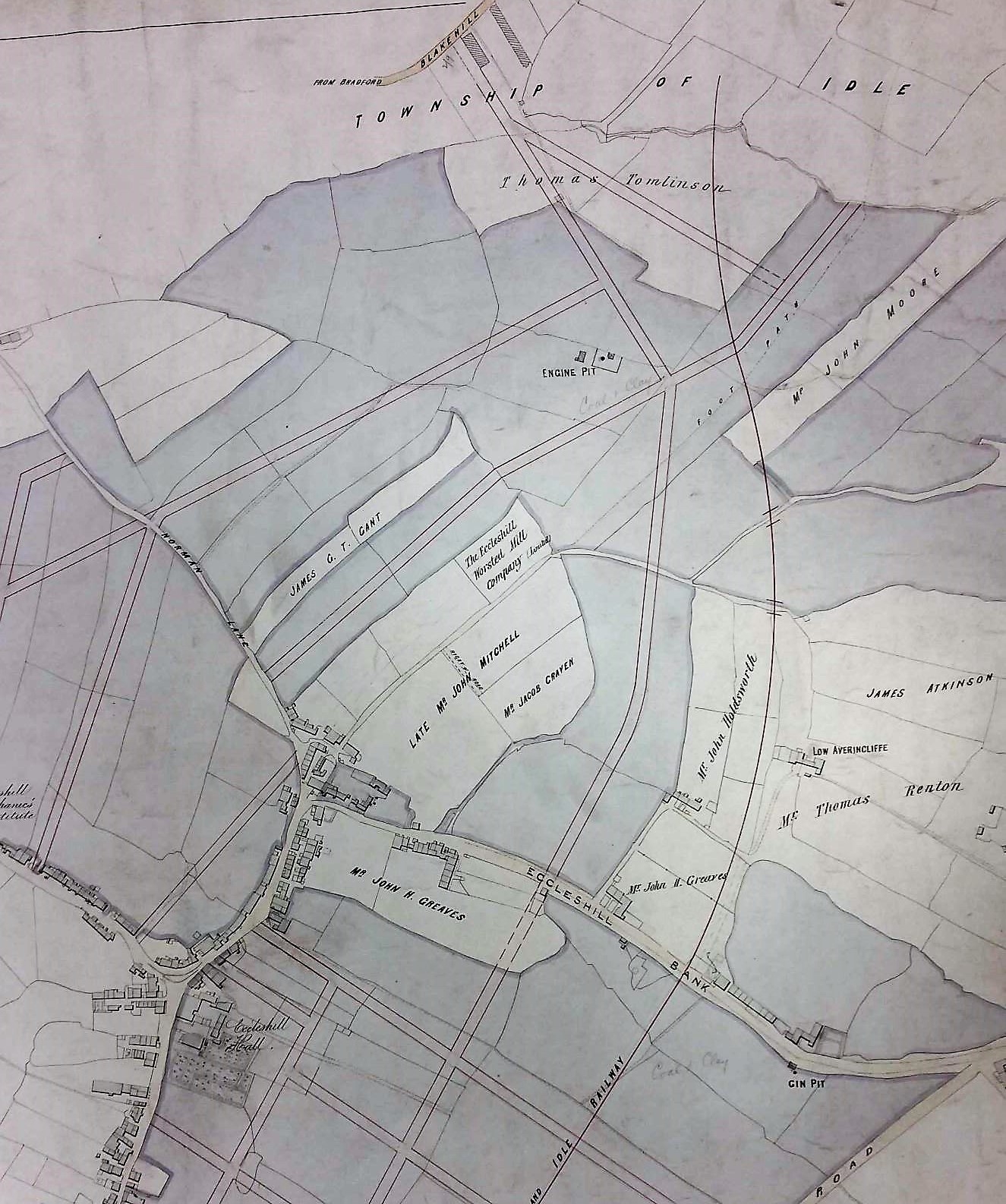
Lime stone quarry near Bowling Junction, and close to a mineral way to Bowling Iron Works. In this position it must represent the working of a moraine deposit (detail from 1852 OS map).

With the construction of the of the Shipley to Skipton sections of Leeds-Liverpool Canal (1773-74) plentiful supplies of limestone became available from the Skipton quarries.  The cheap movement of limestone and coal were among the original ambitions of the canal promoters. Once you had supplies of limestone you required some means of burning it. Local scholar Maggie Fleming, is currently collecting information about canal-side lime kilns, and early lime-burning from erratic boulders, particularly at Micklethwaite and Bingley. Between 1774-83 the Bradford Lime Kiln Co. had eight kilns in Bradford at a site between Broadstones and Spinkwell Lock.  There was evidently an extensive canal-side lime-burning industry since the first OS map also records kilns at, among other places: Silsden, Riddlesden, Micklethwaite, Crossflatts, Bingley (Toad Lane), Dowley Gap, and Shipley.

image C

A map of 1863 recording lime kilns near the centre of Bradford.

There were a number of lime kiln designs including some very advanced Hoffman continuous kilns like the one preserved at Stainforth, N.Yorks. Simple stone built field kilns were once common in this area. They were charged with broken stone and coal from above, with quicklime and ashes being raked out from below. The field name ‘lime-kiln close’ or ‘kiln close’ may reflect this older lime-burning industry. There are two fields in Heaton with these names, now located in Heaton Woods. Local historian Tony Woods has studied Rosse archive records from Ireland and can demonstrate that Heaton coal pits were supplying a lime-kiln, somewhere near, with fuel as long ago as 1776.

Image D

Field kiln near Grassington

If you would like to do more reading on this topic may I suggest:

J.V. Stephens et al. Geology of the country between Bradford and Skipton, HMSO, 1953, 149-151, 149. This is essential reading for geological background to any local extractive industry.

David Johnson, Limestone Industries of the Yorkshire Dales, Amberley, 2010. It is inconceivable that anyone could ask a question about limestone that this book cannot answer.

Gerald & Sheila Young, Micklethwaite: the History of a Moorland Village. The early section of this book describes has an interesting account of the exploitation of local mineral resources.

Derek Barker, Local Studies Library Volunteer

Neglected Bradford industries: Coal mining

Bradford is famous for spinning and weaving but textile production was only one of a group of important industries which ‘Worstedopolis’ supported.  Since several are now almost forgotten by contemporary citizens I should like to draw attention to those which seem unreasonably neglected, in a series of short articles.

Bradford lies on the northern edge of the great Yorkshire & Nottinghamshire coal field. The solid rocks under the city, called the ‘Coal Measures’, were laid down on top of the Millstone Grit in the Carboniferous geological period around 320 million years ago. In the Carboniferous ‘Bradford’ was near the equator and must have witnessed episodes of luxuriant tropical fern and horsetail growth, together with muddy coastal lagoons, vast debris deposits from a river delta, and occasional incursions of the sea. A little like the Florida Everglades today perhaps. The rocks created in this way resemble a pile of sponge cakes cut in half and consisting of layers of grey mudstone, sandstones, coal and fireclay. All these minerals once had a commercial value. The remains of many living creatures survive in mudstones or sandstones.  Cliffe Castle Museum, Keighley has an important collection of such fossils.

If you examine any portion of the first Ordnance Survey map of Bradford, surveyed in the late 1840s, you will see collieries, coal pits and ‘old pits’ scattered everywhere. Coal production was clearly a huge industry and in the 1860s Bradford produced as much of the mineral as Barnsley. In addition to a domestic supply coal was needed for coke manufacture, town gas production, and to power many hundreds of the Borough’s steam engines. It would have fuelled industries such as brick-making and lime-burning which will be examined in future articles. Coal was brought into the town centre and sold from staithes, this being a place adjacent to a highway from which merchants could collect a supply for subsequent delivery to their customers.

02 Image A

This 200 year old map of east Bradford shows the position of two coal staithes. The date is probably around 1825 since Leeds Road is labelled as ‘New Road’.

In this map one staithe is clearly marked J.S. & Co. This must represent John Sturges (or Sturgess) & Co., which was the company that operated Bowling Iron Works. The ‘new rail road’ drawn is in fact a mineral carrying tramway bringing coal in trucks to the Eastbrook staithe, by rope haulage. There is second coal staithe (or stay) at the junction of Well Street and Hall Ings. This is evidently operated by J.J. & Co. who I cannot yet identify. There were staithes adjacent to the canal basin and the bulk transport of coal was very much in the minds of the first canal promoters.

In north Bradford the coal mined was largely from the Hard Bed, Soft Bed and 36-Yard seams which are the deepest in the Coal Measures. As you move up the Aire Valley from Bingley towards Keighley there were a further set of collieries based on even deeper seams of coal in the underlying Millstone Grit series of rocks. Coal mining in north Bradford may have been very extensive, but the coal seams were thin and relatively unproductive.  At the better capitalised late 18th and 19th century south Bradford pits mineral tramways took at least 50% of the coal mined to supply fuel for the profitable blast furnaces at Bowling and Low Moor. Here thicker seams, higher in the Coal Measures series, were exploited. Ironstone and coal were removed from the Black Bed and, underneath this, the Better Bed provided coal low in sulphur and phosphorus, ideal for coke fuelled iron smelting. Most old mine workings are now concealed by urban development but even today walks in Heaton or Northcliffe Woods, or on Baildon Moor, will reveal unmistakable evidence of a mining landscape.

02 Image B

One of the many capped colliery shafts on Baildon Moor.

It is likely that the Romans exploited coal in Britain and there were certainly medieval collieries in northern England. I know of good historical evidence for mining in Baildon, Heaton, Shipley, Frizinghall, and Eccleshill in the early 17th century but the Bradford industry is almost certain to have been older, and more widespread. As an example of the evidence there are a series of West Yorkshire Deeds, published in 1931 by the Bradford Historical & Antiquarian Society,  and available in the Local Studies Library. One deed reveals that in 1684 Ellen Robinson conveyed her ‘Coles, mynes, seames and quarries of cole’ near a place called Mooreside. Would this be the Moorside, Eccleshill where the Industrial Museum is now situated? Remarkably the rent required of William Rawson, yeoman of Bowling, is ‘one red rose yearly’. Was a ‘rose rent’ effectively a way of giving the beneficiary, a relative perhaps, all the income from a parcel of land while not transferring its title of ownership? The colour of the rose is rather surprising if the parties involved were both from Yorkshire.

The earliest mining described by Bradford historian William Cudworth was a little later in 1699 when about twenty freeholders of Bolton entered into a mutual agreement for ‘getting’ coal in that township. The rights to the coal were generally vested in the landowner but a Lord of the Manor retained rights to coal under common land or ‘wastes’. The most frequent way of reaching coal seams was by means of shafts sunk from the surface. Once a shaft was in place the miners created galleries from which the coal was actually removed, with pillars of mineral being left to support the gallery roof. This technique is often called ‘pillar and stall’ mining with the stall (or bord) being the place in which the miners worked at a coal face. Because of these unmined pillars the ‘take’ of coal from a seam may have been as little as 60%. Traditionally coal was not mined under churches, nor the mine-owner’s house!

02 Image C

A beautiful colliery plan from the  reserve map collection showing  pillar & stall mining below Old Allen Common, Wilsden.

As well a shaft to access the galleries a second ventilation shaft was often sunk. When a colliery was working active men were needed as ‘getters’ to hew the coal. If the seams were thin this must have been undertaken in a lying or kneeling position illuminated only by flickering candlelight. Hewed coal was then conveyed in wicker baskets, called corves, by ‘hurriers’ to the shaft bottom from which it could be wound up to the surface by ‘gins’ of various types. Where the topography was favourable seams could also be approached by driving in roughly horizontal tunnels, called inclines, drifts, or ‘day-holes’. Local mining by both methods is well recorded. For Wilsden, for example, there are maps held by both West Yorkshire Archives (Bradford) and the LSL. The Archives have a plan (WYB346 1222 B16) of Old Allen Common in Wilsden including all its collieries. This was ‘made for the purpose of ascertaining the best method of leasing the coal’ by Joseph Fox, surveyor, in 1829. It shows the area where Edward Ferrand, as Lord of the Manor, had mineral rights over common land.

The name ‘bell pit’ is commonly encountered in accounts of early mining. In this method a short shaft was sunk down to a seam and its base was then expanded as the mineral was removed, creating a bell-like profile. When unsafe, because of potential roof collapse, the bell was abandoned and a new shaft sunk nearby. Each bell was filled in turn by waste dug out of its successor. I feel that if shafts were connected underground, or were drained by a passage to the exterior (called an adit or sough), or had some means of providing fresh air for its miners, it seems misleading to call such arrangements ‘bell pits’. ‘Shallow shaft mining’ is perhaps to be preferred which covers all these possibilities.

If you want to explore local coal mining further I would suggest:

J.V. Stephens et al., Geology of the country between Bradford and Skipton, HMSO, 1953. This is essential reading for geological background to any extractive industry.

Richardson, A Geography of Bradford, University of Bradford (1976). This work provides a gentle introduction to mining as it also does to Bradford’s development.

M.C. Gill, Keighley Coal, NMRS, 2004. A most detailed study by an eminent mining authority.

D.J. Barker & T. Woods, Cash from the Coal Measures: the Extractive Industries of Nineteenth Century Shipley.  Bradford Antiquary, (2013) 3rd series, 17, 17-36.


Derek Barker, Local Studies Library Volunteer


Map of the Week: Eccleshill – coal, iron, and waving wheat.

The ancient township of Eccleshill is well represented in the Local Studies Library reserve map collection, although many of the maps are in poor condition. The following images are details which I have enhanced to make them more visible. It is hard to believe today but the whole of Eccleshill was once mined for coal, with mining features commonly being seen on nineteenth century maps of the district. The seams that could be accessed included the Hard and Soft Beds (sometimes called the Upper and Lower Beds) which were widely exploited all over the north Bradford area. Above these in the geological sequence was the important vein of sandstone called the Elland Flags, which was extensively quarried. The well-known George Vint, with his various partners, owned quarries in nearby Idle extracting this valuable rock. Modern geology maps suggest that the centre of Eccleshill was high enough to include the Better Bed coal and fire-clay seams, positioned above the Elland Flags. The Better Bed was also extensively mined as coking coal in south Bradford for the iron-smelting industry at Bowling and Low Moor. William Cudworth, in his account of Eccleshill, mentions the Better Bed, and also an associated fire-clay and brick making industry based at Manor Potteries in Eccleshill.

Ecc1

Click on map to enlarge

The first map shows the township field names with buildings and the names of their occupiers. At the bottom right is Eccleshill Hall built in 1713 and the home of the Stanhope (later Stott-Stanhope) family. As far as I know Lt.-Col. George Stott-Stanhope was the last family member to actually live there. He was a large landowner whose name frequently appears in local maps. He died in 1874 and the hall was demolished in 1878. Slightly to the left you should be able to make out the name J.A. Jowett. This was James Atkinson-Jowett (1817-1886) of the Clockhouse Estate, Manningham. The Clockhouse name survives as one of the Bradford Boys’ Grammar School buildings. James Atkinson-Jowett was the son of Nathan Atkinson-Jowett. Both men changed their surname from plain Atkinson in the 1860s in order to claim the large Jowett property inheritance. The field names are not likely to be easily visible but include: Windmill Field and Tenter Croft. A tenter croft, or ground, was an area used for drying newly woven woollens after fulling. The wet cloth was attached to frames called tenters by means of, naturally, tenter-hooks. Town Street, today called Victoria Road, divides at Bank Top into Norman Lane and Eccleshill Bank, named the ‘Old Turnpike Road’ in early maps. This division is very helpful in orientation, with portions of Eccleshill Bank being included in all the maps included here.

The second, rather clearer, map enables us to examine the northern part of Eccleshill. It is obvious that a planned street grid has been superimposed on an older map but I do not think that all those roads were actually constructed. On the right side of the map a railway line has appeared. The Eccleshill & Idle Railway was incorporated in 1866 and was assimilated into the GNR Laisterdyke to Shipley line. Eccleshill Station was closed to passengers in 1931. A land-owner whose name appears approximately in the centre of the map is described as the ‘late John Mitchell’. Eccleshill historian Ken Kenzie told me that John or Jonathan Mitchell was a coal merchant who once lived at Eccleshill Bank. He was clearly a big man in Eccleshill mining and, among others, ran Park Pits which were sold off in 1860 when he was in his 70s. On the map above his surname you may be able to make out the location of ‘Eccleshill Worsted Mill Company’ and above this, and to the left, ‘Engine Pit’. The enterprises of John Mitchell are well represented in the Local Studies map collection.

ecc2

Click on map to enlarge

The third image is taken from a plan dated 1847 and described as ‘coals leased to Mr John Mitchell, surveyed by Ingle & Smith’. Once again you can see Eccleshill Bank and the fine line grid above it represents underground mine galleries. I presume these were entered from the Engine Pit shaft. Elsewhere the map reveals extensive coal mining to the south-west of the township.

ecc3

Click on map to enlarge

The final map is the oldest and most damaged. In one area I can identify George Baron as a landowner. George Baron, of Drewton in the Wolds, was an earlier possessor of the Clockhouse Estate than the Atkinson-Jowetts. He inherited the estate from Sarah, last of the original Jowett family, and died in 1854. The West Yorkshire Archives (Bradford) has a huge collection of Jowett family documents (10D76/3/190). In box 6 of these is a lease dated 1842: ‘George Baron to John Mitchell, Eccleshill’. This document is a 28 year lease of Upper Bed and Lower Bed coals in the area of Greengates, Eccleshill. The price seems to be £60 per acre. This is somewhat north of the area discussed so far, but Greengates and Apperley Bridge were traditionally considered to be part of Eccleshill.


ecc4

Click on map to enlarge

The short horizontal trackway at the top of the last map is called Green Lane. It joins a bridleway which is now Carr Bottom Lane. We have moved west since the curved roadway at the top left, marked Otley, is the far end of Eccleshill Bank where it joins the Dudley Hill & Killinghall turnpike. A number of coal shafts are present on the first OS map of the area (which is of approximately the same date) together with a limekiln at the end of the short track leading to Wheat Close. I’m not sure if these are drawn here or not since the script is so hard to read. What fascinates me about this map are the field names themselves. At the bottom right you may be able to make out Wheat Close and, below this, Cinder Hills. Today it is hard to imagine ripe wheat being harvested in Eccleshill although we have already mentioned Windmill Field which suggests subsequent grain processing. Cinder Hills is a name normally associated with heaps of iron-making slag. Pre-Industrial iron making has been suggested in other townships which now form part of Bradford: Harden, Baildon and Bierley for example. Faull & Moorhouse (West Yorkshire Survey to AD 1500) speculated that Eccleshill should join this list on the basis of two areas called ‘Cinderhills’ in old township maps.


Derek Barker, Local Studies Library Volunteer

Neglected Bradford Industries: Iron-smelting

Bradford is famous for spinning and weaving but textile production was only one of a group of important industries which ‘Worstedopolis’ supported. Since several  are now almost forgotten by contemporary citizens I should like to draw attention to those which seem unreasonably neglected, in a series of short articles.

The production of copperas (iron sulphate) and glass in the Bradford area have been completely forgotten. Brick-making has escaped serious study until quite recently. It is the extent, rather than the existence, of quarrying, coal-mining and iron-smelting that has tended to pass out of memory. I shall try to provide a brief introduction to these industries and to some smaller concerns: pottery, fireclay production, lime burning and vitriol manufacture. My survey cannot be exhaustive since I know very little about soap boiling, clay pipe production, nail making or leather tanning. I hope any reader with knowledge of these activities will feel free to contribute. Although my main interest is in the history of technology I am not unaware that the successes I shall describe came at considerable human cost. In the period selected the rural poor were driven by a need for work into factories and crowded, unsanitary, housing. Some employers, like Titus Salt, were humane men but others were exploitative. Foundries, mines and vitriol works were dangerous places where often little thought was given to worker safety. Those who paid the price of progress seldom reaped its benefits.

Bradford had many advantages as an industrial centre. Building stone was relatively easy to acquire, and since the late eighteenth century there had been a vigorous brick industry. Cheap local coal was available, and could be coked to supply blast furnaces which made pig iron from locally dug ironstone. There had long been water-powered corn and textile mills but it was the introduction of steam engine power that really transformed any process that was capable of mechanisation. Cloth production was a principle beneficiary of this technology which in turn promoted the development of textile engineering in Bradford and Keighley. The town was originally a communications backwater. It was hard to move raw materials, or manufactured products, cheaply and speedily. Horse transport had been used for centuries and a network of pack-horse routes had developed throughout West Yorkshire. The construction of turnpike roads in the years 1734-1825 produced a substantial improvement in the situation. With the opening of sections of the Leeds to Liverpool canal in the 1770s, with its spur into Bradford, transport of bulk goods, especially coal and limestone, became far cheaper. Railway links were established by the 1850s.

Iron1

A 30.5 ton Rolling Mill flywheel presented by Alan Elsworth and preserved for display near the site of Low Moor Ironworks.

A century ago no community would be without its blacksmith but Bradford could boast a complete package of iron based technologies: ironstone mining, iron-smelting, and foundries. Historical sources, and deposits of slag, suggest that a medieval, bloomery furnace based, iron-smelting had occurred at Eldwick, Harden, Baildon, and Eccleshill, with charcoal being the fuel employed. Until their dissolution around 1539 northern Cistercian abbeys were heavily involved in iron-making but there is some documentary evidence of late Tudor smelting at Esholt and Hirst Wood, Shipley.  The origin of modern industry was the discovery in 1709, by Quaker ironmaster Abraham Darby of Coalbrookdale, that iron could be successfully smelted using coked coal. This advance took about 50 years to be widely accepted. Darby’s grandson was the creator of the famous iron bridge.

Iron2

An iron pig produced by Abraham Darby in 1756, on display at Coalbrookdale Museum.

Bradford did not have the capacity to produce vast quantities of charcoal for blast furnace fuel but Darby’s discovery resulted in south Bradford’s Black Bed coal seam being mined for its rich roof deposits of ironstone. It was discovered that the deeper Better Bed coal seam was low in sulphur and phosphorus and so produced coke highly suitable for iron-smelting. The  industry was capital intensive but blast furnaces were set up at Birkenshaw (1782), Bowling (1788), Low Moor (1791) and Bierley (1810). Their products were cast iron and the ‘best wrought iron’, produced by Cort’s ‘puddling’ process. Cannon and shot were manufactured during the Napoleonic Wars. At a later date the companies did not adopt the Bessemer process to convert cast iron into steel for which Sheffield became celebrated. The furnaces are long gone but the ‘dross’ waste and some of the iron products remains. I vividly remember encountering some Low Moor cannon at Alnwick Castle. As local deposits were exhausted mineral carrying tramways transported vast amounts of coal and ironstone for miles towards the furnaces. In the 1960s a scholar called Derek Pickles studied the mineral ways supplying Bowling Iron Works. His detailed and fascinating work is curated by Bradford Industrial Museum but I know virtually nothing about him. Can anybody help me?

Iron3

A plan from Derek Pickles’s study showing mineral ways around Bowling Iron Works (top centre). The triangles mark collieries.


If you want to undertake further background reading the Local Studies Library has copies of three useful texts:

  • RCN Thornes, West Yorkshire: A Noble Scene of Industry, WYCC (1981)
  • Gary Firth, Bradford in the Industrial Revolution, Ryburn Publishing (1990)
  • C Richardson, A Geography of Bradford, University of Bradford (1976)

Derek Barker, Local Studies Library Volunteer

Map of the Week – Holdsworth Street Mill

The Local Studies Library houses hundreds of maps and plans in its reserve collection. My role as a volunteer is to provide the library staff with a report on the nature and condition of this material within an acceptable time frame, perhaps a few years. Consequently I can spend a few minutes at most with each map, although I use articles like this to display items which really deserve more detailed study. This plan is neither named nor dated. We have to ask four questions: what was it, where was it, when was it, and whose was it? Other Local Studies Library resources help to provide some answers to these questions.

Map of the Week 009

Click on map to open in a new window

Clearly we have the integrated premises of a worsted manufacturer with a spinning mill and weaving shed, both provided with independent steam power. The cottages included would not have housed more than a tiny fraction of the workforce. Perhaps they were occupied by men whose permanent presence on-site was desirable, such as ostlers or night watchmen. A substantial warehouse is included, but there is no dye house. As was common practice woven pieces must have been sent to commission dyers. A counting house was essentially a works office. I was puzzled by the sizing room but it seems that warps were treated, or sized, to make them stronger.

Where was this mill sited? Canal Road and Valley Road are two long sides of a scalene triangle that meet near the city centre immediately west of the canal. Holdsworth Street was the shorter third side that completed the triangle. It still exists, approached from the small roundabout from which you drive to Forster Square Station, but demolition and road development has left no visible trace of these buildings. Holdsworth Street and the spinning mill are present on the first OS map of the area (1851). The weaving shown here is not in the arrangement recorded in the 1851 OS nor the Bradford tithe map. Is our map older, or more recent? A nearby land owner is evidently the Bradford Gas & Light Company which was founded in the 1820s. The area involved remained the site of the Bradford Gas works for many decades to come.

Notice that the mill is adjacent to the William Rouse estate. I have briefly researched the Rouse family. William Rouse snr. (1765-1843) was a worsted spinner and weaver. His company (Wm. Rouse & Son) appears in the 1822 Gazetteer of the West Riding located at ‘Canal Side’. In subsequent trade directories it is placed nearby at: Mill Street, Canal Road, North Brook Street and, in 1872, Holdsworth Street. I am not sure if the same mill was being referred to on each occasion since in the Factory Commission report (1833) data was collected from three Rouse Mills, the oldest at Canal Side being built in 1815. The company’s closest brush with history must have been in 1820-22 when Titus Salt spent two years with them ‘learning the trade’ under the direction of John Hammond (see Jack Reynolds, The Great Paternalist, 1983, p.46). Rouse must have produced worsted stuff in the years before wool-combing was mechanised. With his son John (1794-1838) he employed hundreds of hand-combers who worked for him producing the wool ‘tops’ needed for the worsted process. By the time of William’s death the writing was on the wall for the poorly paid hand-combers whose trade was effectively destroyed by mechanical combs in the 1850s. The business clearly continued despite its founder’s death and the changing technology.

The 1853 White’s Leeds & the Clothing District Directory mentions a William Rouse, spinner & manufacturer, of West Lodge, Great Horton Road. William Rouse jnr. (1809-1868) had evidently succeeded his father. In the 1851 census Rouse reported employing 400 combers, 100 boys, and 150 girls. He may not have been too hard an employer since, on a Saturday in September 1849, the Bradford Observer records a works trip to Clapham by special train. Some employees saw the famous caves and others played cricket. All enjoyed a good dinner, and were home by 10 pm. William Rouse jnr. did everything expected of a successful textile man: church warden 1847, town counsellor 1848, magistrate 1852, and Poor Law overseer in 1860. By 1861 he was living in Burley House, Burley with his wife, children and six servants. He died there in 1868.

By the time of the 1879 PO Bradford Directory Wm. Rouse & Sons are placed at North Brook Street Mills. North Brook Street joins Canal Road just north of our map.  North Brook Mills are mentioned in the book Yorkshire Textile Mills 1779-1930 (RCHME) but unfortunately they had already been demolished when the mill survey was undertaken in the early 1990s. The mill in the plan is present in the 25 inch OS map of 1891. It seems to be linked to the named North Brook Street Mill but the mill building was then a warehouse, and the weaving shed was divided up between a repository and an engineering shop.

Wm. Rouse & Sons is included in The Century’s Progress, an 1893 work of self-publicity produced for Yorkshire industries. This states that the company was run by John, Frank and Herbert Rouse, grandsons of William Rouse snr. It is said to have operated ‘a vast home and export trade’ and to have had 40,000 spindles and 900 workers. The entry describes the company occupying the ‘Old Mills’ and the ‘New Mills’ acquired half a century earlier, that is in the 1840s. It states that the New Mills were in North Brook Street. I imagine that at some stage the company had created the premises illustrated in the plan but I am not sure if it was ‘Old’ or ‘New’. Can anyone help me?

Derek Barker, Local Studies Library Volunteer